Walnut Creek in Contra Costa County, California — The American West (Pacific Coastal)
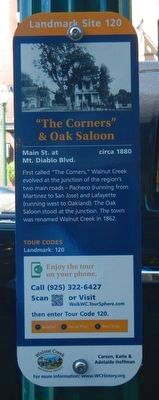
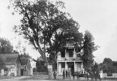
"The Corners" & Oak Saloon
Main St. at Mt. Diablo Blvd.
— circa 1880 —
First called "The Corners," Walnut Creek evolved at the junction of the region's two main roads - Pacheco (running from Martinez to San Jose) and Lafayette (running west to Oakland). The Oak Saloon stood at the junction. The town was named Walnut Creek in 1862.
Erected by Walnut Creek Historical Society. (Marker Number 120.)
Topics and series. This historical marker is listed in this topic list: Settlements & Settlers. In addition, it is included in the California - Walnut Creek Heritage Walk series list.
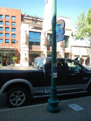
Location. 37° 53.857′ N, 122° 3.601′ W. Marker is in Walnut Creek, California, in Contra Costa County. Marker is on North Main Street near Mt. Diablo Boulevard, on the right when traveling north. Touch for map. Marker is at or near this postal address: 1308 North Main Street, Walnut Creek CA 94596, United States of America. Touch for directions.
Other nearby markers. At least 8 other markers are within walking distance of this marker. Sherburne Building (a few steps from this marker); Oldest Commercial Building (within shouting distance of this marker); Judge Duncan's Courtroom (within shouting distance of this marker); Harlan's Livery Stable (within shouting distance of this marker); Downtown Traffic (within shouting distance of this marker); Flagpole (within shouting distance of this marker); San Ramon Valley Bank (within shouting distance of this marker); Main Street, 1910 (within shouting distance of this marker). Touch for a list and map of all markers in Walnut Creek.
More about this marker. This marker is a part of the Walnut Creek Heritage Walk.
Also see . . .
1. History of Walnut Creek - Walnut Creek Chamber of Commerce. Walnut Creek was first known as “The Corners,” where the roads leading from Pacheco and Lafayette converged. Today those “corners” are at the intersection of Mt. Diablo Boulevard and North Main Street. The area’s first settler was a squatter named William Slusher. In 1849, Slusher built the first roofed abode on the bank of what was then known as “Nuts Creek” (in the area of the Broadway Plaza parking garage). (Submitted on April 9, 2016, by Barry Swackhamer of Brentwood, California.)
2. Walnut Creek Historical Society. Organization website (Submitted on October 30, 2020, by Larry Gertner of New York, New York.)
Credits. This page was last revised on February 12, 2021. It was originally submitted on April 9, 2016, by Barry Swackhamer of Brentwood, California. This page has been viewed 443 times since then and 24 times this year. Photos: 1, 2, 3. submitted on April 9, 2016, by Barry Swackhamer of Brentwood, California.


