Fenton in Genesee County, Michigan — The American Midwest (Great Lakes)
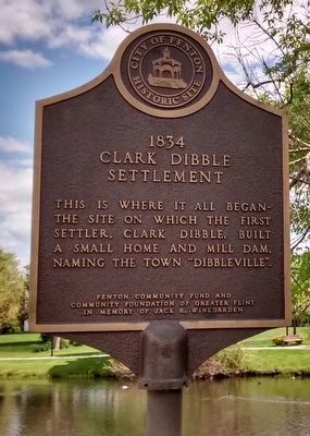
1834 Clark Dibble Settlement
This is where it all began—the site on which the first settler, Clark Dibble, built a small home and mill dam, naming the town "Dibbleville".
Erected by Fenton Community Fund and Community Foundation of Greater Flint.
Topics. This historical marker is listed in this topic list: Settlements & Settlers.
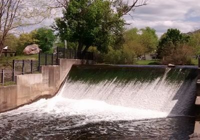
Location. 42° 47.648′ N, 83° 42.232′ W. Marker is in Fenton, Michigan, in Genesee County. Marker can be reached from East Ellen Street. The marker is in Millpond Park. It is near the dam, about 200 feet from the parking lot behind Fenton Fire Hall (accessed from East Ellen Street). Touch for map. Marker is at or near this postal address: 201 South Leroy Street, Fenton MI 48430, United States of America. Touch for directions.
Other nearby markers. At least 8 other markers are within walking distance of this marker. 1840 Grindstone from Fenton Mills (within shouting distance of this marker); 1889 A.J. Phillips Work Office (about 400 feet away, measured in a direct line); Dibbleville Business District I (about 500 feet away); Riggs Hotel (about 500 feet away); Dibbleville (about 500 feet away); Dibbleville Business District II (about 600 feet away); 1838 Judge Daniel LeRoy's Law Office (about 600 feet away); Fenton United Methodist Church (about 700 feet away). Touch for a list and map of all markers in Fenton.
Credits. This page was last revised on June 16, 2016. It was originally submitted on May 22, 2016, by Joel Seewald of Madison Heights, Michigan. This page has been viewed 568 times since then and 37 times this year. Photos: 1, 2. submitted on May 22, 2016, by Joel Seewald of Madison Heights, Michigan.

