Near Lander in Fremont County, Wyoming — The American West (Mountains)
"The Sinks"
Inscription.
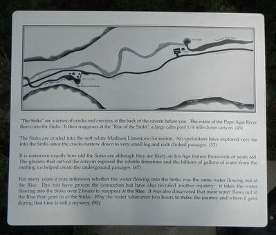
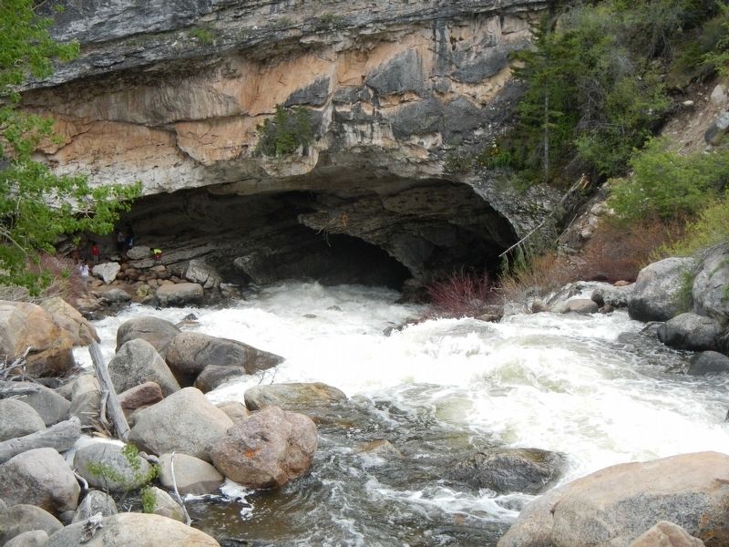
“The Sinks” are a series of cracks and crevices at the back of the cavern before you. The water of the Popo Agie River flows into the Sinks. It then reappears at the “Rise of the Sinks,” a large calm pool ¼ mile down canyon. (45)
The Sinks are eroded into the soft white Madison Limestone formation. No spelunkers have explored very far into the Sinks since the cracks narrow down to very small log and rock chocked passages. (33)
It is unknown exactly how old the Sinks are although they are likely an Ice-Age feature thousands of years old. The glaciers that carved the canyon exposed the soluble limestone and the billions of gallons of water from the melting ice helped create the underground passages. (47)
For many years it was unknown whether the water flowing into the Sinks was the same water flowing out at the Rise. Dye test have proven the connection but have also revealed another mystery: it takes the water flowing in the Sinks over 2 hours to reappear at the Rise. It was also discovered that more water flows out at the Rise than goes in at the Sinks. Why the water takes over two hours to make the journey and where it goes during that time is still a mystery. (90)
Erected by Wyoming State Parks and Cultural Resources.
Topics. This historical marker is listed in this topic list: Natural Features.
Location. 42° 44.868′ N, 108° 48.594′ W. Marker is near Lander, Wyoming, in Fremont County. Marker can be reached from Sinks Canyon Road (State Highway 131), on the left. Touch for map. Marker is at or near this postal address: 3148 Sinks Canyon Road, Lander WY 82520, United States of America. Touch for directions.
Other nearby markers. At least 8 other markers are within 8 miles of this marker, measured as the crow flies. Sinks Canyon - Corridor to the Winds (within shouting distance of this marker); The Rise of the Sinks (approx. 0.4 miles away); Popo Agie Power (approx. 0.4 miles away); Sinks Canyon (approx. 0.9 miles away); Site of Fort Augur (approx. 7.1 miles away); Noble Lane Building (approx. 7.1 miles away); Fremont Hotel (approx. 7.1 miles away); M.N Baldwin Co. (approx. 7.1 miles away). Touch for a list and map of all markers in Lander.
More about this marker. This marker is located in Sinks Canyon State Park, about 7 miles southwest of Lander.

Photographed By Barry Swackhamer, May 29, 2016
2. The Sinks, second marker
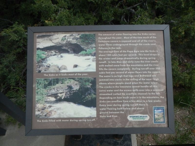
The amount of water flowing into the Sinks varies throughout the year. Most of the time much of the limestone cavern is exposed and all of the river’s water flows underground through the cracks and fishures (sic) in the rock.
The average flow of the Popo Agie into the Sinks is about 100 cubic feet per second. This level drops in the winter and jumps dramatically during spring runoff. In late May and early June the river swells with melted snow from the mountains and the river fills the cavern completely. During run-off over 500 cubic feet per second of water flows into the cavern. The water is so high that logs and driftwood ear jammed into cracks in the ceiling of the cave – high above where people stand when the water is low. The cracks in the limestone cannot handle all this extra water and the excess spills over into a seasonal streambed (called the overflow channel) to the left. Depending on how much snow is in the mountains, the Sinks can overflow from a few days to a few weeks. Every year during spring run-off there is water flowing both below and above ground between the Sinks and Rise.
Captions: (top left) The Sinks as it looks most of the year.; (bottom left) The Sinks filled with water during spring run-off.
Credits. This page was last revised on July 14, 2016. It was originally submitted on July 14, 2016, by Barry Swackhamer of Brentwood, California. This page has been viewed 458 times since then and 12 times this year. Photos: 1, 2, 3. submitted on July 14, 2016, by Barry Swackhamer of Brentwood, California.
Editor’s want-list for this marker. An overview of the makers located at The Sinks overlook • Can you help?

