St. Mary's City in St. Mary's County, Maryland — The American Northeast (Mid-Atlantic)
After the Disastrous Fire
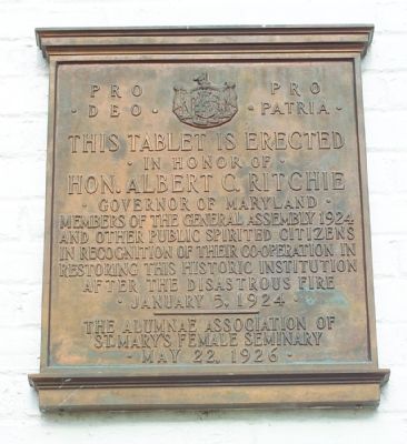
Pro Deo. Pro Patria. This tablet erected in honor of Hon. Albert C. Ritchie, Governor of Maryland, members of the General Assembly 1924 and other public spirited citizens in recognition of their co-operation in restoring this historic institution after the disastrous fire, January 5, 1924.
Erected 1926 by The Alumnae Association of St. Mary’s Female Seminary on May 22.
Topics and series. This historical marker is listed in this topic list: Entertainment. In addition, it is included in the Maryland, Saint Mary's City series list. A significant historical month for this entry is January 1839.
Location. 38° 11.253′ N, 76° 26.067′ W. Marker is in St. Mary's City, Maryland, in St. Mary's County. Marker is on Trinity Church Road near Point Lookout Road (Maryland Route 5). Marker is on Calvert Hall on the campus of St. Mary’s College of Maryland. Touch for map. Marker is in this post office area: Saint Marys City MD 20686, United States of America. Touch for directions.
Other nearby markers. At least 10 other markers are within walking distance of this marker. Saint Mary's Female Seminary (here, next to this marker); St. Mary's College of Maryland Land Acknowledgement and Pledge (a few steps from this marker); The Gift of the Society of the Ark and the Dove (within shouting distance of this marker); The St. Mary’s Chapel (within shouting distance of this marker); Sharing Land and Legacy (within shouting distance of this marker); “…a convenient place for the administration of Justice.” (within shouting distance of this marker); Trinity Church, St. Mary’s Parish (within shouting distance of this marker); Leonard Calvert (about 300 feet away, measured in a direct line); Here Lyeth The Body (about 300 feet away); Entrance to First State House of Maryland (about 300 feet away). Touch for a list and map of all markers in St. Mary's City.
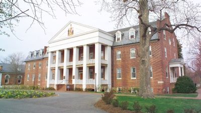
More about this marker. Marker is on the right column at the main entrance to Calvert Hall.
Regarding After the Disastrous Fire. “In January of 1924, the seminary was almost destroyed by fire. A fire started in the basement of the main building and spread quickly because of strong storm winds. The fire department in Leonardtown was called, but it never came because of mechanical trouble with the fire truck. According to Shanah McClure from the Enterprise, ‘There are reports of local citizens who worked for more than seven hours in subfreezing temperatures
to save the monument school, but to no avail.’ However, ‘Several items were saved due to the efforts of both students and community members who formed a kind of brigade—carrying out school records, furniture, library books, and bags of mail from the St. Mary’s City Post Office.’ Some were certain that the fire would mean the end of the school. Instead, a temporary place for classes was found in the town of Scotland to the south and the school was rebuilt. In fact, this led to the school’s new role as a junior college.” —excerpt from page 128 of Tobacco to Tomcats... St. Mary’s County since the Revolution by Sandy Shoemaker
Also see . . . St. Mary's College of Maryland, originally known as St. Mary's Female Seminary. Wikipedia entry (Submitted on July 20, 2022, by Larry Gertner of New York, New York.)
Credits. This page was last revised on July 20, 2022. It was originally submitted on April 23, 2007, by Tom Fuchs of Greenbelt, Maryland. This page has been viewed 2,205 times since then and 30 times this year. Photos: 1. submitted on April 23, 2007, by Tom Fuchs of Greenbelt, Maryland. 2. submitted on April 20, 2007, by Tom Fuchs of Greenbelt, Maryland. • J. J. Prats was the editor who published this page.

