Burkesville in Cumberland County, Kentucky — The American South (East South Central)
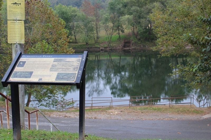
Burkesville Ferry
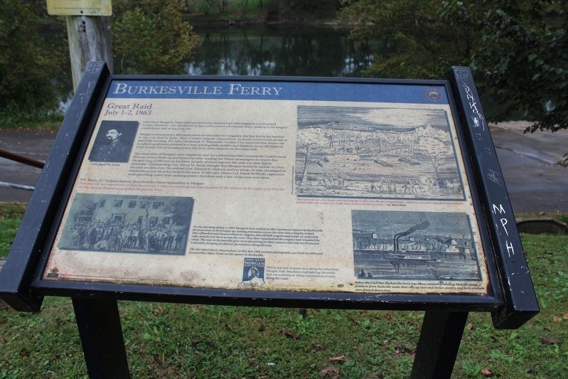
Great Raid
ó July 1-2, 1863 ó
Morgan commanded 2,460 cavalrymen divided into two brigades, the first led by his brother-in-law, Col. Basil W. Duke. Most of Dukeís brigade crossed here, on boats constructed on site to speed the crossing. Pvt. John Weathered, 9th Tennessee Cavalry, CSA, reported that about one hundred cavalrymen crossed at a time, placing their saddles and blankets on an old flatboat. Their horses, forced to swim across the river, were claimed on the other side.
The remainder of Morganís nine regiments and the commissary train crossed the Cumberland River at various fords up and down the river, leading the Union newspapers to report that Morgan had 10,000 men in his force. In spite of these reports, the area was only lightly defended. Commanding Gen. Henry M. Judah thought that Morgan would be unable to cross the rain-swollen river. He ordered Gen. Edward H. Hobson and his troops to stay encamped at Marrowbone just 10 miles away to the west. To the east, Union Col. Frank Wolford's regiments were patrolling many river crossing points; therefore only a few of his men were here.
P.H. Burns, 22nd Indiana Battery, described the Union opposition to Morgan:
"This was our first experience to face the enemy. A little skirmishing was had in some of the ravines as he came over, but the old fox slipped around us, and then began the race..."
(captions)
Col. Basil W. Duke
On the morning of July 2, 18 Morgan's men waited on the Courthouse Square in Burkesville for provisions to be brought up. Getting provisions across the river was a lengthy ordeal. Men offloaded and disassembled the wagons, placed both wagons and cargo on makeshift rafts, and ferried them across the river. They then assembled the wagons and reloaded the cargo. The men in Burkesville grew tired of waiting for their rations and rode north toward Columbia, foraging for food at farmhouses along the way.
The Herriford Hotel, shown above in this late 19th century photograph, was build in 1850 and fronted West Main Street on the square in Burkesville.
"the river was out of its banks and running like a mill-race. The first brigade had...only two crazy little flats, that seemed ready to sink under the weight of a single man, and two or three canoes." Col. Basil Duke
Before the Civil War, Burkesville Ferry was a busy steamship landing. Manufactured products from Nashville made their way up river and timber, poultry, and farm products were floated down river.
Erected by Kentucky Heartland Civil War Trails Commission.
Topics and series. This historical marker is listed in these topic lists: War, US Civil • Waterways & Vessels. In addition, it is included in the John Hunt Morgan Heritage Trail in Kentucky series list. A significant historical date for this entry is July 1, 1863.
Location. 36° 47.167′ N, 85° 21.95′ W. Marker is in Burkesville, Kentucky, in Cumberland County. Marker is on Banks Street south of Upper River Street, on the right when traveling south. Touch for map. Marker is at or near this postal address: 214 Upper River St, Burkesville KY 42717, United States of America. Touch for directions.
Other nearby markers. At least 8 other markers are within walking distance of this marker. The History of Cumberland County (approx. 0.2 miles away); The Coe Family / The Coes of Cumberland County (approx. 0.4 miles away); Morgan On To Ohio (approx. 0.4 miles away); Lincoln's Father Here (approx. 0.4 miles away); Cumberland Countians War Memorial (approx. 0.4 miles away); Cumberland County (approx. 0.4 miles away); Raiders Entered Here (approx. 0.4 miles away); Smith Pharmacy (approx. 0.4 miles away). Touch for a list and map of all markers in Burkesville.
Credits. This page was last revised on October 19, 2016. It was originally submitted on October 18, 2016, by Tom Bosse of Jefferson City, Tennessee. This page has been viewed 731 times since then and 54 times this year. Photos: 1, 2, 3, 4. submitted on October 18, 2016, by Tom Bosse of Jefferson City, Tennessee. • Bernard Fisher was the editor who published this page.


