Photograph as originally submitted to
this page in the Historical Marker Database
www.HMdb.org.
Click on photo to resize in browser. Scroll down to see metadata.
Photographer: William Fischer, Jr.
Taken: March 29, 2010
Caption:
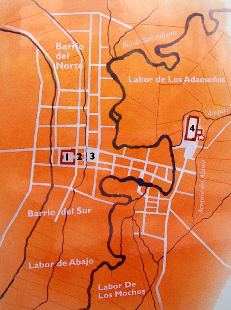
Map of San Antonio de Béjar at close of the 18c. | Submitted: May 22, 2010, by William Fischer, Jr. of Scranton, Pennsylvania.
Database Locator Identification Number: p110085
File Size: 0.120 Megabytes
To see the metadata that may be embedded in this photo, sign in and then return to this page.