Photograph as originally submitted to
this page in the Historical Marker Database
www.HMdb.org.
Click on photo to resize in browser. Scroll down to see metadata.
Photographer: Thomas Chris English
Taken: July 1, 2010
Caption:
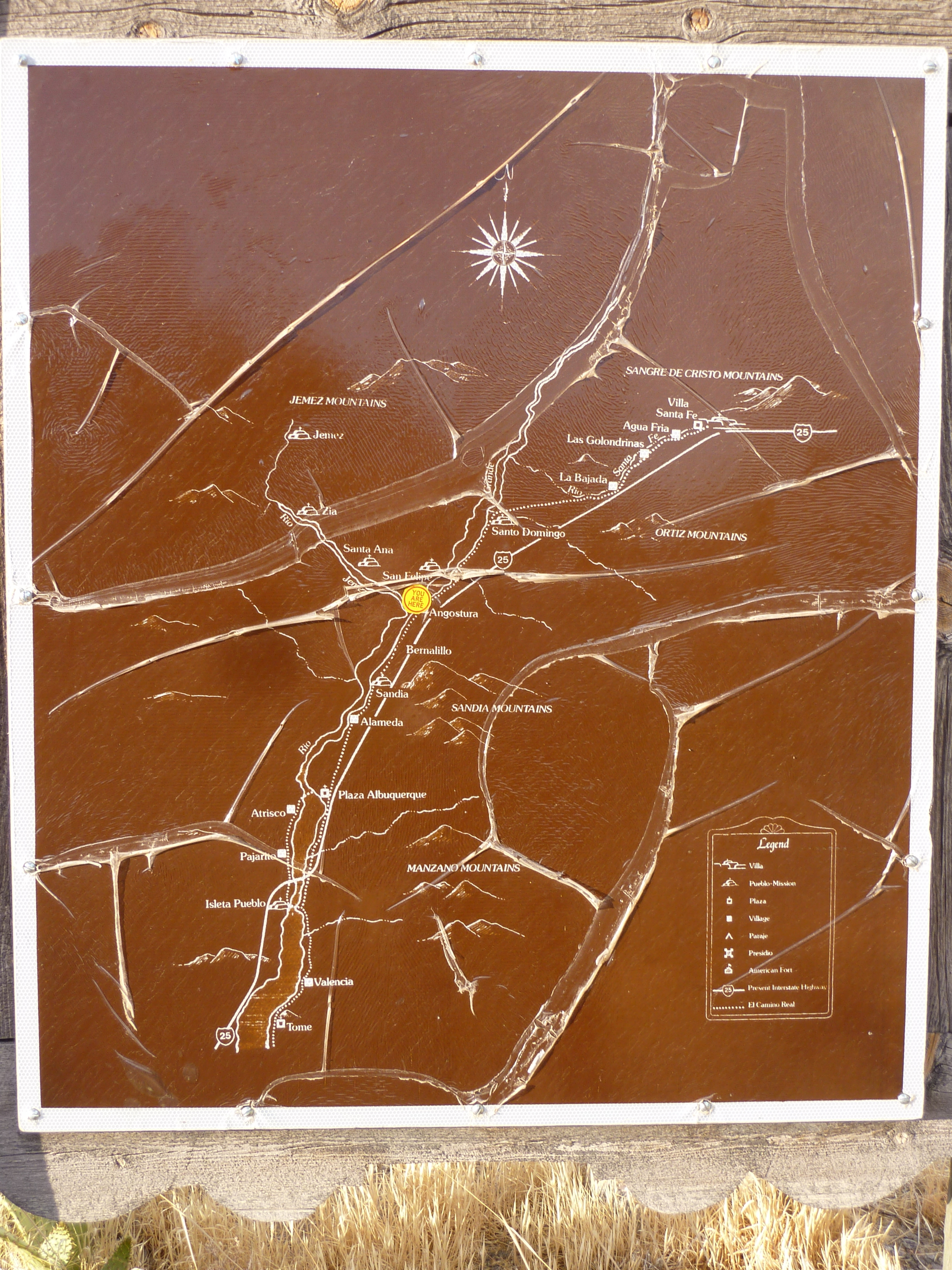
La Angostura Marker - Reverse | Additional Description: New Mexico Historic Marker Maps
The state's Official Scenic Historic Markers usually have a map on the reverse side showing the location of more local markers. For the ardent historical marker seeker, these maps are a mine of information, waiting for extraction.
Submitted: July 8, 2010, by Chris English of Phoenix, Arizona.
Database Locator Identification Number: p116575
File Size: 4.984 Megabytes
To see the metadata that may be embedded in this photo, sign in and then return to this page.