Photograph as originally submitted to
this page in the Historical Marker Database
www.HMdb.org.
Click on photo to resize in browser. Scroll down to see metadata.
Photographer: David Bullard
Taken: June 21, 2010
Caption:
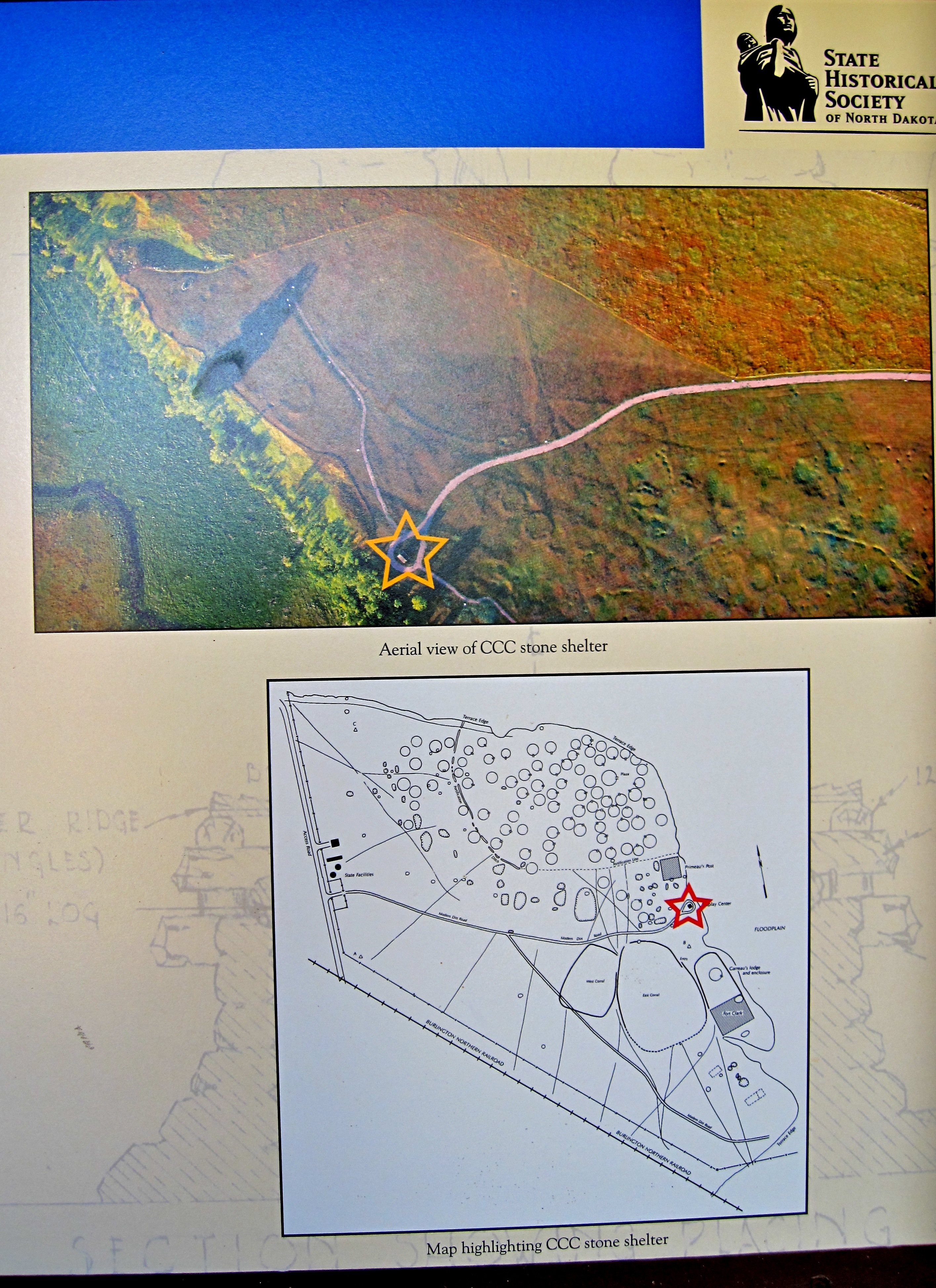
Aerial View and Map | Additional Description: In the aerial photograph south is up. In the map north is up. The location of the CCC shelter is marked with the star.
Submitted: July 20, 2010, by David Bullard of Seneca, South Carolina.
Database Locator Identification Number: p118521
File Size: 3.587 Megabytes
To see the metadata that may be embedded in this photo, sign in and then return to this page.