Photograph as originally submitted to
this page in the Historical Marker Database
www.HMdb.org.
Click on photo to resize in browser. Scroll down to see metadata.
Photographer: William Fischer, Jr.
Taken: August 12, 2010
Caption:
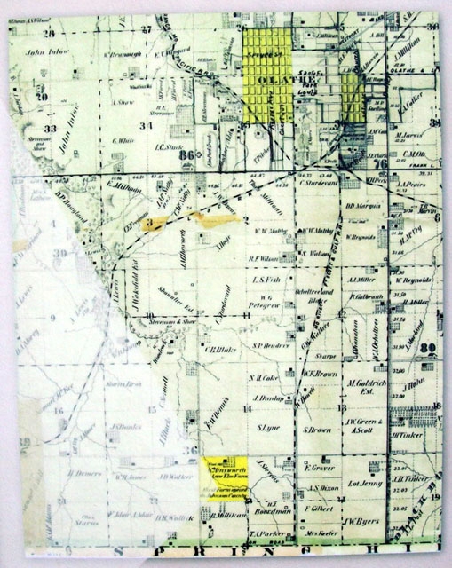
County Map on Trail To Park Marker | Additional Description: [Caption reads] The 1874 Johnson County Atlas depicts the boundaries of Olathe and the location of the Ainsworth farm. A detailed drawing of the Ainsworth farm (bottom left) also appeared in the 1874 Atlas.
Submitted: August 13, 2010, by William Fischer, Jr. of Scranton, Pennsylvania.
Database Locator Identification Number: p122438
File Size: 0.144 Megabytes
To see the metadata that may be embedded in this photo, sign in and then return to this page.