Photograph as originally submitted to
this page in the Historical Marker Database
www.HMdb.org.
Click on photo to resize in browser. Scroll down to see metadata.
Photographer: William Fischer, Jr.
Taken: August 12, 2010
Caption:
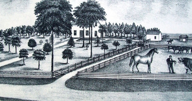
Ainsworth Property on Trail To Park Marker | Additional Description: [Caption reads] This map and the Ainsworth Property illustration both appeared in the 1874 Johnson County Atlas. The view is looking to the South. The road pictured here is now 167th Street. [Illustration reads "Olathe Township, Johnson County, Kansas, Section 23, T.14, Range 23"]
Submitted: August 13, 2010, by William Fischer, Jr. of Scranton, Pennsylvania.
Database Locator Identification Number: p122439
File Size: 0.121 Megabytes
To see the metadata that may be embedded in this photo, sign in and then return to this page.