Photograph as originally submitted to
this page in the Historical Marker Database
www.HMdb.org.
Click on photo to resize in browser. Scroll down to see metadata.
Photographer: Craig Swain
Taken: July 24, 2010
Caption:
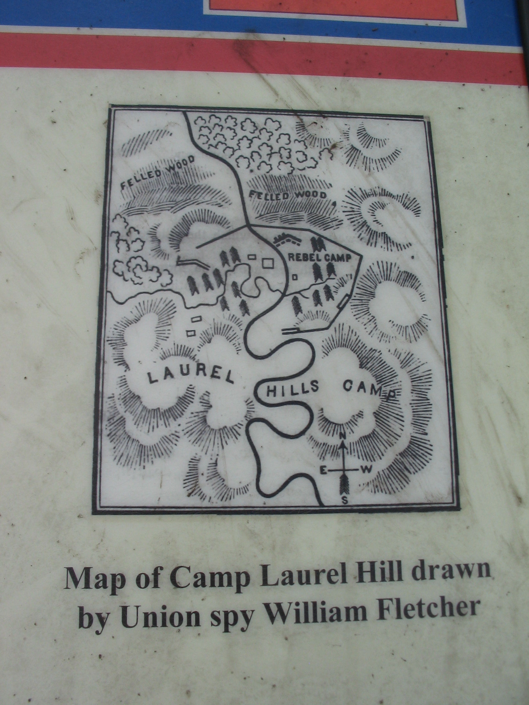
Map of the Camp | Additional Description: Map of Camp Laurel Hill drawn by Union spy William Fletcher.
Submitted: August 15, 2010, by Craig Swain of Leesburg, Virginia.
Database Locator Identification Number: p122721
File Size: 0.913 Megabytes
To see the metadata that may be embedded in this photo, sign in and then return to this page.