Photograph as originally submitted to
this page in the Historical Marker Database
www.HMdb.org.
Click on photo to resize in browser. Scroll down to see metadata.
Photographer: William J. Toman
Taken: August 10, 2010
Caption:
Closeup of Sidebar on Lead Display | Additional Description:
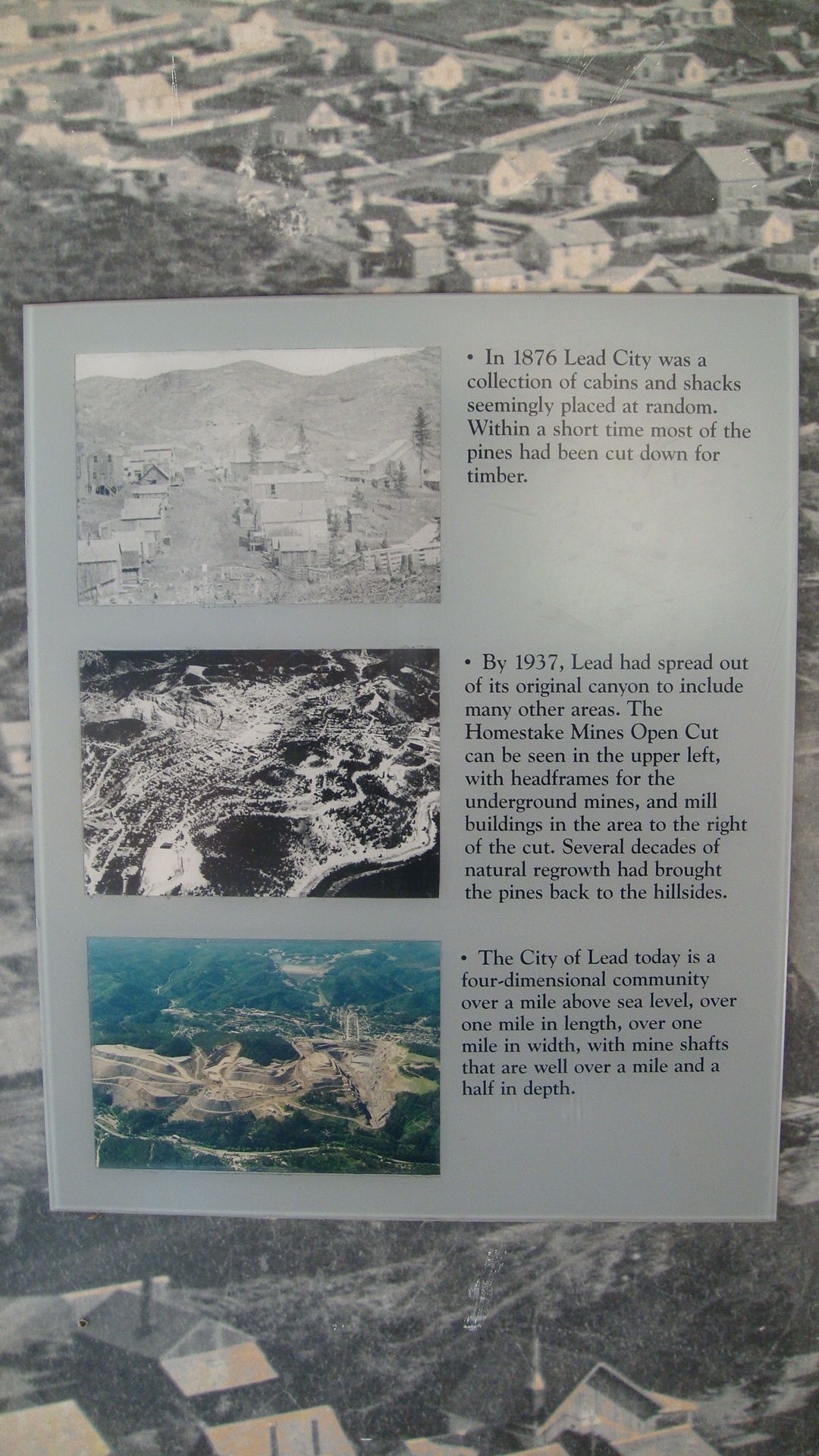
Text for first photo:
• In 1876 Lead City was a collection of cabins and shacks seemingly placed at random. Within a short time most of the pines had been cut down for timber.
Text for second photo:
• By 1937, Lead had spread out of its original canyon to include many other areas. The Homestake Mines Open Cut can be seen in the upper left, with headframes for the underground mines, and mill buildings in the area to the right of the cut. Several decades of natural regrowth had brought the pines back to the hillsides.
Text for third photo:
• The City of Lead today is a four-dimensional community over a mile above sea level, over one mile in length, over one mile in width, with mine shafts that are well over a mile and a half in depth.
Submitted: August 23, 2010, by William J. Toman of Green Lake, Wisconsin.
Database Locator Identification Number: p124078
File Size: 0.805 Megabytes
To see the metadata that may be embedded in this photo, sign in and then return to this page.