Photograph as originally submitted to
this page in the Historical Marker Database
www.HMdb.org.
Click on photo to resize in browser. Scroll down to see metadata.
Photographer: Kevin W.
Taken: August 20, 2010
Caption:
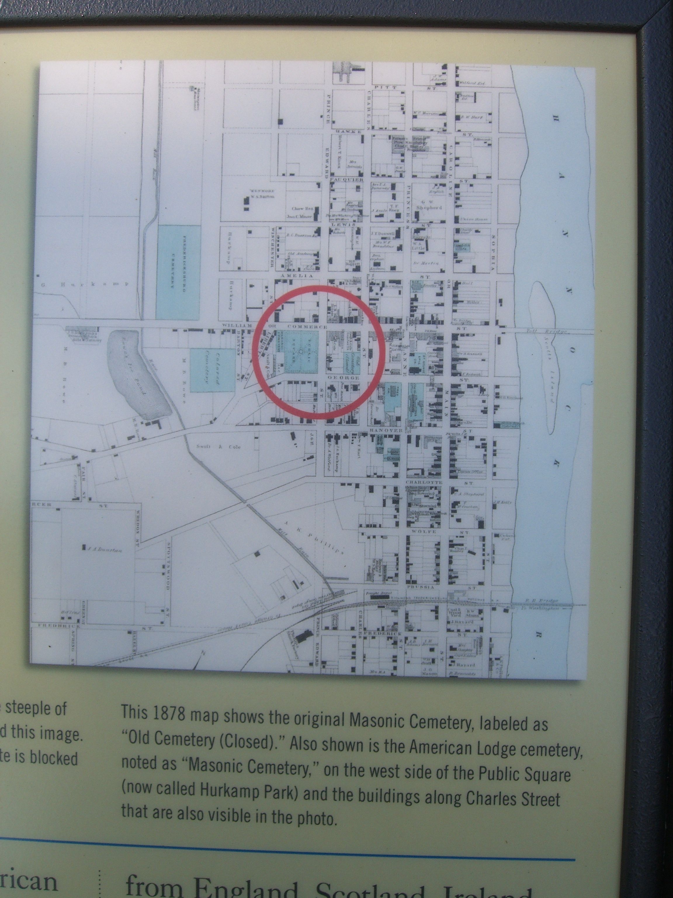
Map on the Masonic Cemetery Marker | Additional Description: This 1878 map shows the original Masonic Cemetery, labeled as “Old Cemetery (Closed).” Also shown is the American Lodge cemetery, noted as “Masonic Cemetery,” on the west side fo the Public Square (now called Hurkamp Park) and the buildings along Charles Street that are also visible in the photo.
Submitted: August 24, 2010, by Kevin W. of Stafford, Virginia.
Database Locator Identification Number: p124349
File Size: 2.057 Megabytes
To see the metadata that may be embedded in this photo, sign in and then return to this page.