Photograph as originally submitted to
this page in the Historical Marker Database
www.HMdb.org.
Click on photo to resize in browser. Scroll down to see metadata.
Photographer: William J. Toman
Taken: September 2, 2010
Caption:
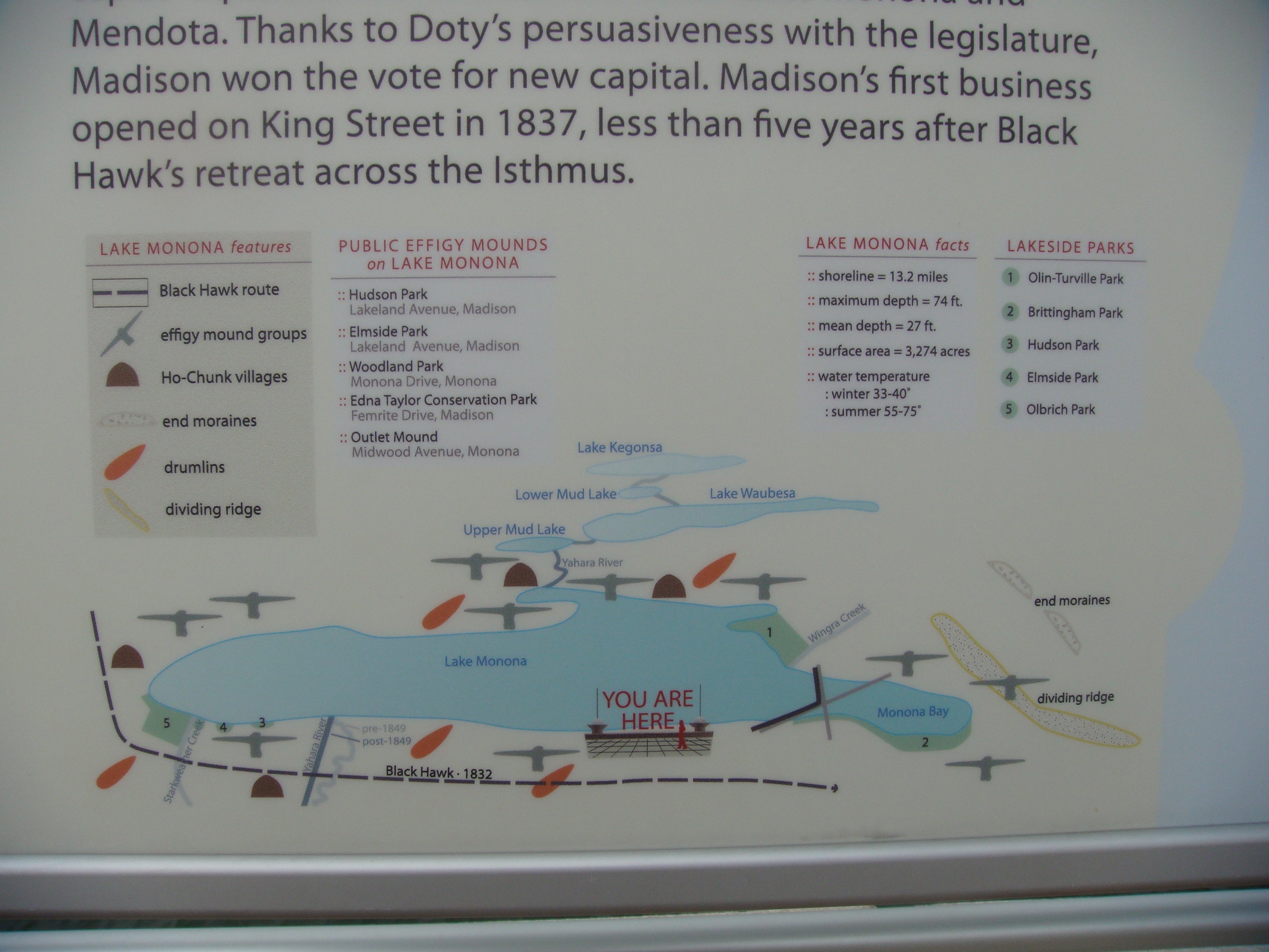
Closeup of Map on Marker | Additional Description: The map shows Black Hawk's route through the isthmus; the locations of effigy mound groups, Ho-Chunk villages, glacial features, and present-day parks; and Lake Monona facts.
Submitted: September 6, 2010, by William J. Toman of Green Lake, Wisconsin.
Database Locator Identification Number: p126253
File Size: 3.460 Megabytes
To see the metadata that may be embedded in this photo, sign in and then return to this page.