Photograph as originally submitted to
this page in the Historical Marker Database
www.HMdb.org.
Click on photo to resize in browser. Scroll down to see metadata.
Photographer: Craig Swain
Taken: September 5, 2010
Caption:
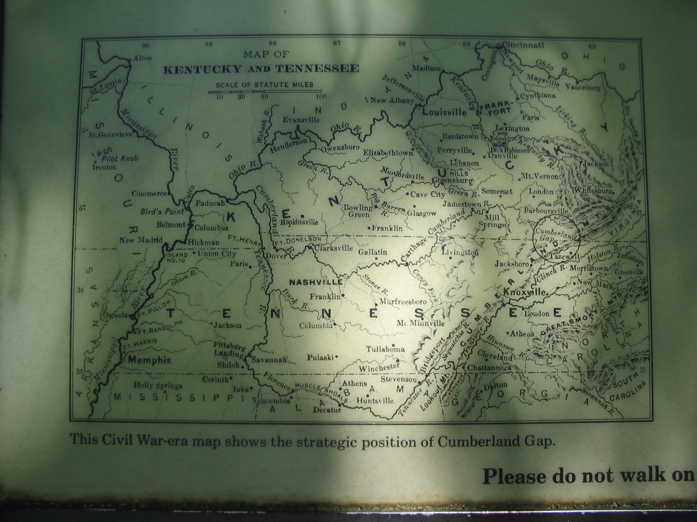
Map of Kentucky and Tennessee | Additional Description:
This Civil War-era map shows the strategic position of Cumberland Gap. Note circle indicating the location of the Gap on the right side of the map.
Submitted: September 14, 2010, by Craig Swain of Leesburg, Virginia.
Database Locator Identification Number: p127793
File Size: 1.064 Megabytes
To see the metadata that may be embedded in this photo, sign in and then return to this page.