Photograph as originally submitted to
this page in the Historical Marker Database
www.HMdb.org.
Click on photo to resize in browser. Scroll down to see metadata.
Photographer: Craig Swain
Taken: September 5, 2010
Caption:
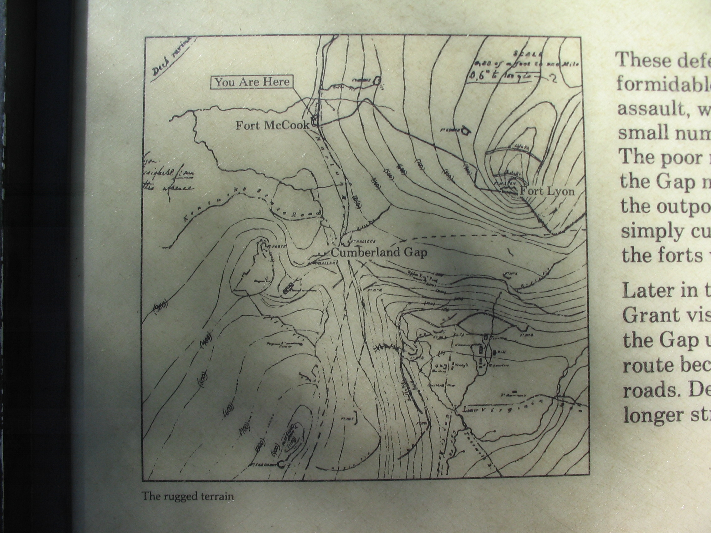
Map of the Fortifications | Additional Description: The map uses topographical survey data, and plots the locations of the wartime forts.
Submitted: September 14, 2010, by Craig Swain of Leesburg, Virginia.
Database Locator Identification Number: p127903
File Size: 1.006 Megabytes
To see the metadata that may be embedded in this photo, sign in and then return to this page.