Photograph as originally submitted to
this page in the Historical Marker Database
www.HMdb.org.
Click on photo to resize in browser. Scroll down to see metadata.
Photographer: Craig Swain
Taken: September 5, 2010
Caption:
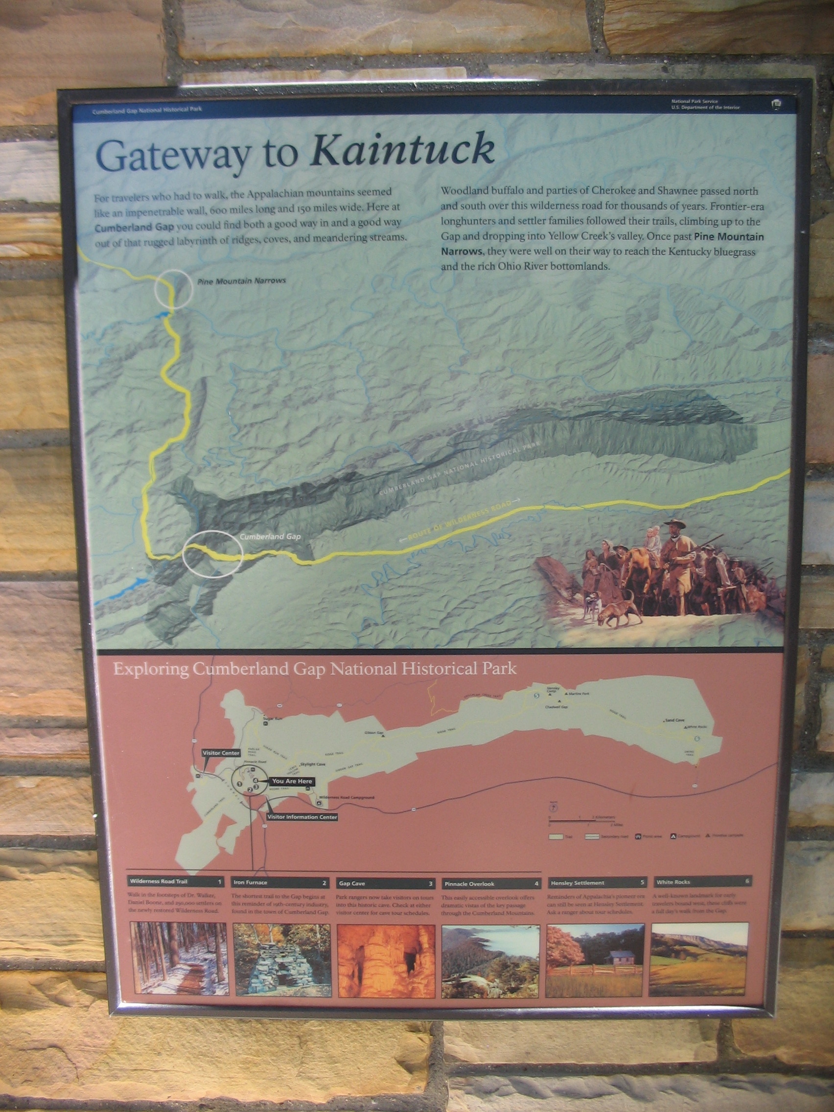
Gateway to Kaintuck | Additional Description: Standard park orientation marker collocated at the site:
For travelers who had to walk, the Appalachian mountains seemed like an impenetrable wall, 600 miles long and 150 miles wide. Here at Cumberland Gap you could find both a good way in and a good way out of that rugged labyrinth of ridges, coves, and meandering streams.
Woodland buffalo and parties of Cherokee and Shawnee passed north and south over this wilderness road for thousands of years. Frontier-era longhunters and settler families followed their trails, climbing up to the Gap and dropping into Yellow Creek's valley. Once past Pine Mountain Narrows, they were well on their way to reach the Kentucky bluegrass and the rich Ohio River bottomlands.Submitted: September 19, 2010, by Craig Swain of Leesburg, Virginia.
Database Locator Identification Number: p128540
File Size: 1.064 Megabytes
To see the metadata that may be embedded in this photo, sign in and then return to this page.