Photograph as originally submitted to
this page in the Historical Marker Database
www.HMdb.org.
Click on photo to resize in browser. Scroll down to see metadata.
Photographer: Craig Swain
Taken: December 22, 2007
Caption:
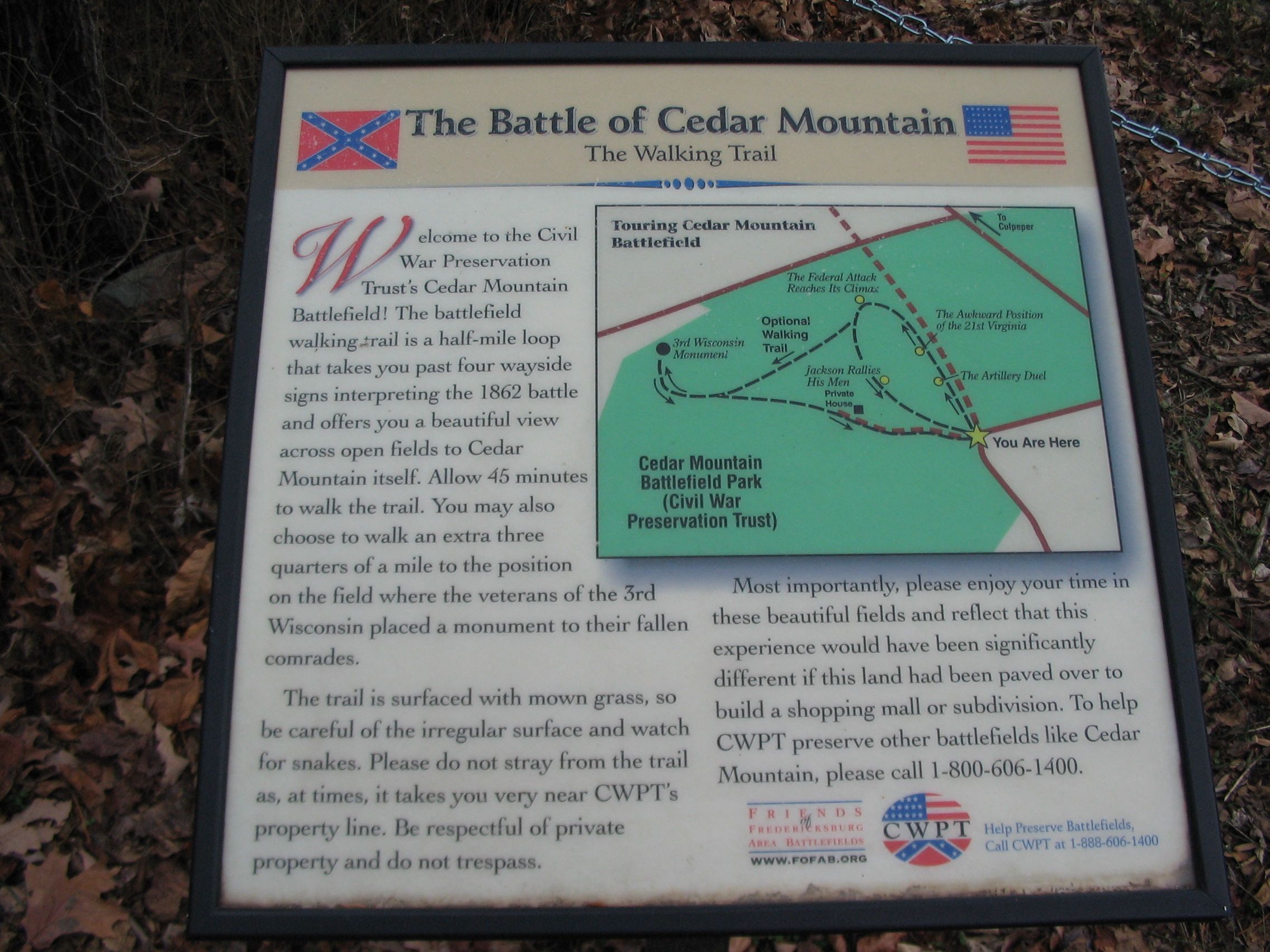
The Battle of Cedar Mountain
The Walking Trail | Additional Description: Standing nearby at the bend of General Winder Road, is the trail head for the Cedar Mountain trail:
Welcome to the Civil War Preservation Trust's Cedar Mountain Battlefield! The battlefield walking trail is a half-mile loop that takes you past four wayside signs interpreting the 1862 battle and offers you a beautiful view across open fields to Cedar Mountain itself. Allow 45 minutes to walk the trail. You may also choose to walk an extra three quarters of a mile to the position on the field where the veterans of the 3rd Wisconsin placed a monument to their fallen comrades.
The trail is surfaced with mown grass, so be careful of the irregular surface and watch for snakes. Please do not stray from the trail as, at times, it takes you very near CWPT's property line. Be respectful of private property and do not trespass.
Most importantly, please enjoy your time in these beautiful fields and reflect that this experience would have been significantly different if this land had been paved over to build a shopping mall or subdivision. To help CWPT preserve other battlefields like Cedar Mountain, please call 1-800-606-1400.
Submitted: January 1, 2008, by Craig Swain of Leesburg, Virginia.
Database Locator Identification Number: p12891
File Size: 0.993 Megabytes
To see the metadata that may be embedded in this photo, sign in and then return to this page.