Photograph as originally submitted to
this page in the Historical Marker Database
www.HMdb.org.
Click on photo to resize in browser. Scroll down to see metadata.
Photographer: Paul Crumlish
Taken: August 2, 2010
Caption:
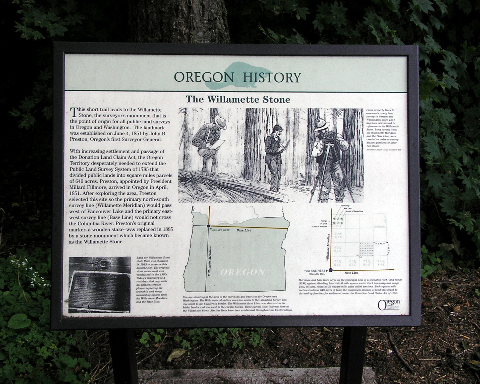
The Willamette Stone Marker | Additional Description: Captions: (bottom left) Land for Willamette Stone State Park was obtained in 1945 to preserve this historic site. The original stone was vandalized in the 1980s. Today's landmark is a stainless steel cap, with an adjacent bronze plaque depicting the township and range numbering system from the Willamette Meridian and the Base Line.; (bottom center) You are standing at the axis of the meridian and baseline for Oregon and Washington. The Willamette Meridian runs due north to the Canadian border and due south to the California border. The Willamette Base Line runs due east to the Idaho boarder and due west to the Pacific Ocean. These survey lines intersect here at the Willamette Stone. Similar lines have been established throughout the United States.; (top right) From property lines to easements, every land survey in Oregon and Washington since 1851 has been determined in reference to the Willamette Stone. Long survey lines, the Willamette Meridian and the Base Line, were created in order to survey distant portions of these two states.; (bottom right) Meridian and base lines serve as the principal axis of a township (N/S) and range (E/W) system, dividing land into 6 mile square units. Each township and range unit, in turn, contains 36 square mile units called sections. Each square mile section contains 640 acres of land, the maximum amount of land that could be claimed by families for settlement under the Donation Land Claim Act of 1850.
Submitted: November 25, 2010, by PaulwC3 of Northern, Virginia.
Database Locator Identification Number: p137945
File Size: 2.122 Megabytes
To see the metadata that may be embedded in this photo, sign in and then return to this page.