Photograph as originally submitted to
this page in the Historical Marker Database
www.HMdb.org.
Click on photo to resize in browser. Scroll down to see metadata.
Photographer: Craig Swain
Taken: September 4, 2010
Caption:
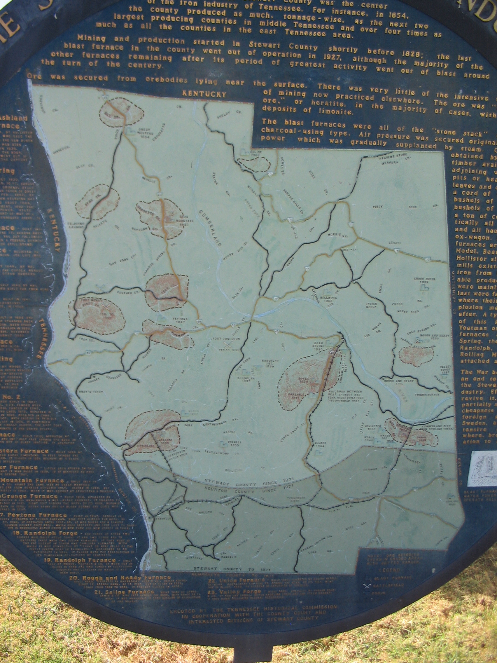
Map of the County Showing Iron Activity | Additional Description: The shaded areas are ore deposits. Icons depicting a building with smoke stack indicate blast furnace locations. Cross sabers indicate battlefields. A forge iron indicates forge locations.
Submitted: December 13, 2010, by Craig Swain of Leesburg, Virginia.
Database Locator Identification Number: p140071
File Size: 1.195 Megabytes
To see the metadata that may be embedded in this photo, sign in and then return to this page.