Photograph as originally submitted to
this page in the Historical Marker Database
www.HMdb.org.
Click on photo to resize in browser. Scroll down to see metadata.
Photographer: Craig Swain
Taken: January 5, 2008
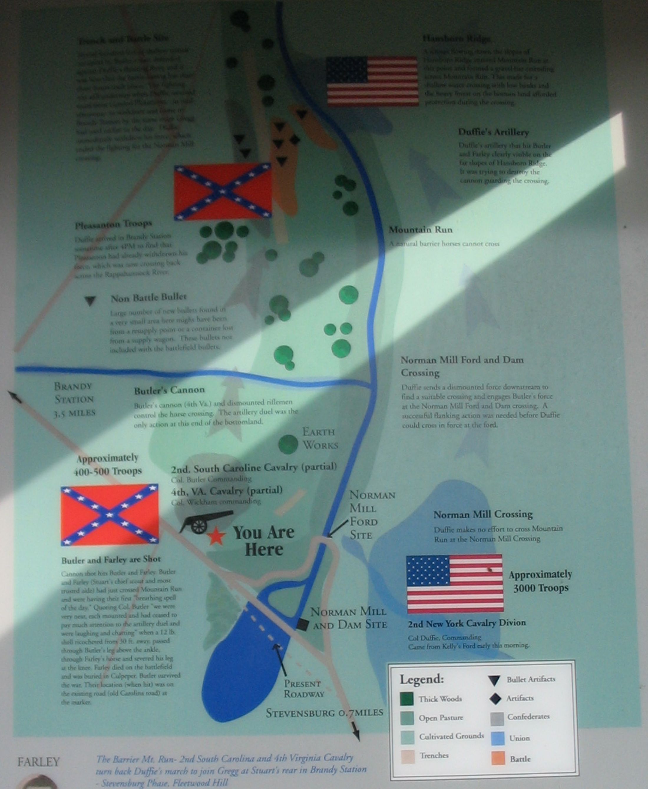
Caption:
Close up of the Map | Additional Description: Key points, from top to bottom, indicated on the map are the sites of the Trenches and Ditch, Hansborough Ridge, Duffie's Artillery, Pleasonton Troops, Mountain Run, Non Battle Bullets, Butler's Cannon, Norman Mill Ford and Dam Crossing, 2nd South Carolina Cavalry, 4th Virginia Cavalry, and the site where Butler and Farley were shot.
Submitted: January 21, 2008, by Craig Swain of Leesburg, Virginia.
Database Locator Identification Number: p14319
File Size: 0.444 Megabytes
To see the metadata that may be embedded in this photo, sign in and then return to this page.