Photograph as originally submitted to
this page in the Historical Marker Database
www.HMdb.org.
Click on photo to resize in browser. Scroll down to see metadata.
Photographer: William Fischer, Jr.
Taken: November 8, 2010
Caption:
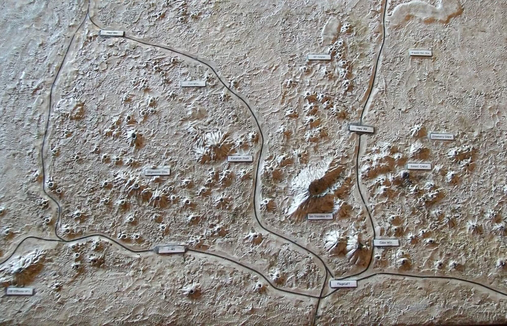
San Francisco Volcano Field Relief Map | Additional Description: In Visitor Center. Flagstaff is in the lower right center of diorama, where roads intersect south of the large crater (San Francisco Peaks).
Submitted: April 14, 2011, by William Fischer, Jr. of Scranton, Pennsylvania.
Database Locator Identification Number: p150111
File Size: 0.204 Megabytes
To see the metadata that may be embedded in this photo, sign in and then return to this page.