Photograph as originally submitted to
this page in the Historical Marker Database
www.HMdb.org.
Click on photo to resize in browser. Scroll down to see metadata.
Photographer: US Surveyor General
Taken: January 10, 1862
Caption:
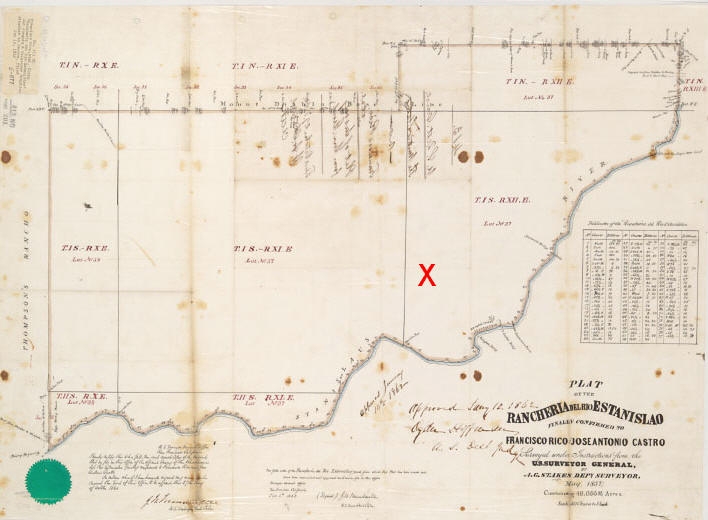
Plat of Rancheria del Rio Estanislao | Additional Description: This image of the plat of the Rancheria del Rio Estanislao (courtesy of the Bancroft Library, University of California at Berkeley), produced by the US Surveyor General in 1862, gives some idea of the size of the nearly 49,000 acre grant. The red X denotes the marker site, and the town of Knight's Ferry, about a mile away, is located roughly at the upper part of the bend of the Stanislaus River that is below and to the right of the X. [Click on image to enlarge]
Submitted: May 1, 2011, by Andrew Ruppenstein of Lamorinda, California.
Database Locator Identification Number: p151917
File Size: 0.055 Megabytes
To see the metadata that may be embedded in this photo, sign in and then return to this page.