Photograph as originally submitted to
this page in the Historical Marker Database
www.HMdb.org.
Click on photo to resize in browser. Scroll down to see metadata.
Photographer: Keith L
Taken: April 27, 2011
Caption:
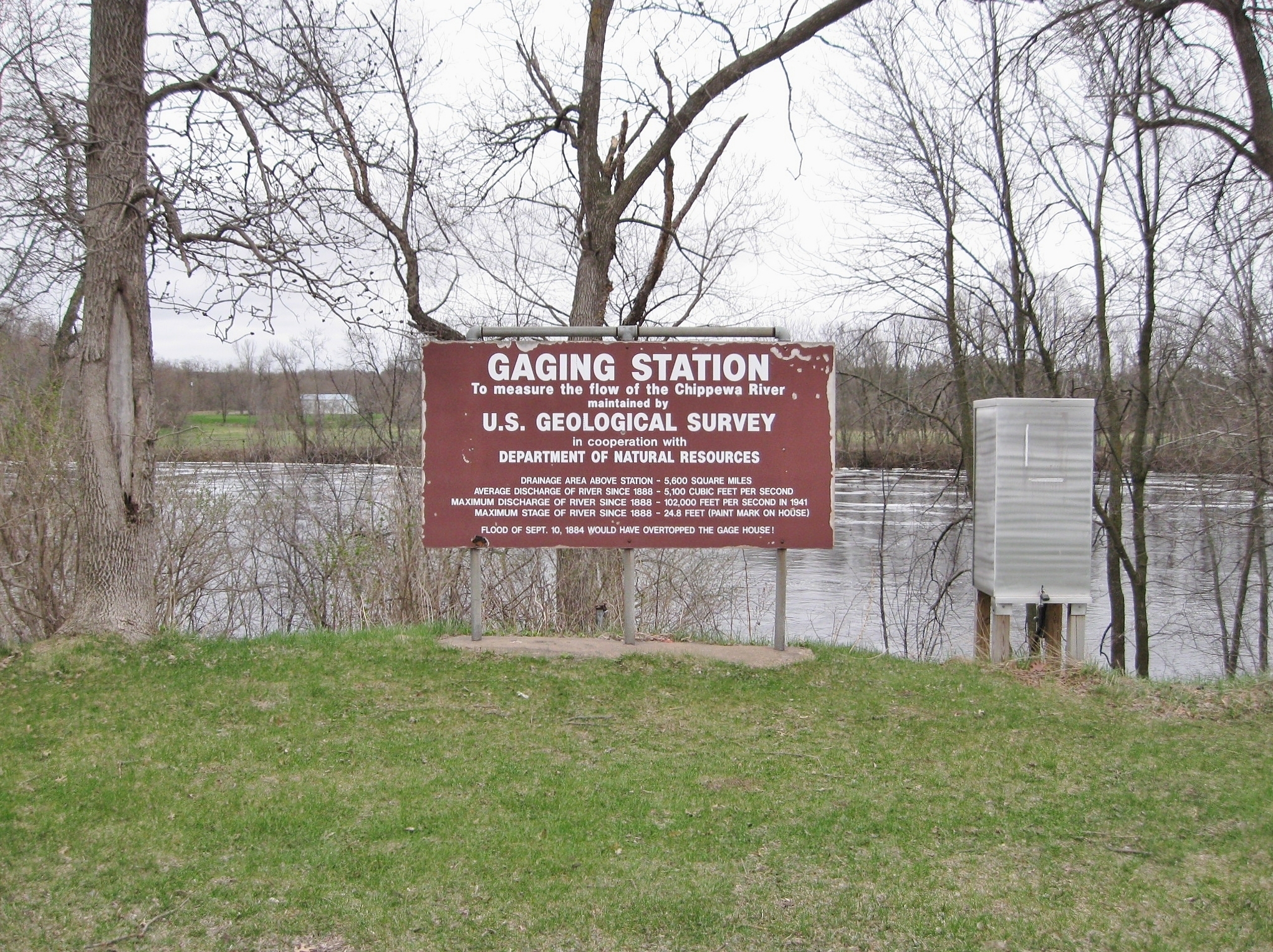
Gaging Station | Additional Description:
[located by the marker]
To measure the flow of the Chippewa River
maintained by
U.S. Geological Survey
in cooperation with
Department of Natural Resources
Drainage area above station - 5,600 square miles
Average discharge of river since 1888 - 5,100 cubic feet per second
Maximim discharge of river since 1888 - 102,000 feet per second in 1941
Maximum stage of river since 1888 - 24.8 feet (paint mark on house)
Flood of Sept. 10, 1884 would have overtopped the gage house!Submitted: May 25, 2011, by Keith L of Wisconsin Rapids, Wisconsin.
Database Locator Identification Number: p154470
File Size: 3.224 Megabytes
To see the metadata that may be embedded in this photo, sign in and then return to this page.