Photograph as originally submitted to
this page in the Historical Marker Database
www.HMdb.org.
Click on photo to resize in browser. Scroll down to see metadata.
Photographer: Stanley and Terrie Howard
Taken: June 18, 2011
Caption:
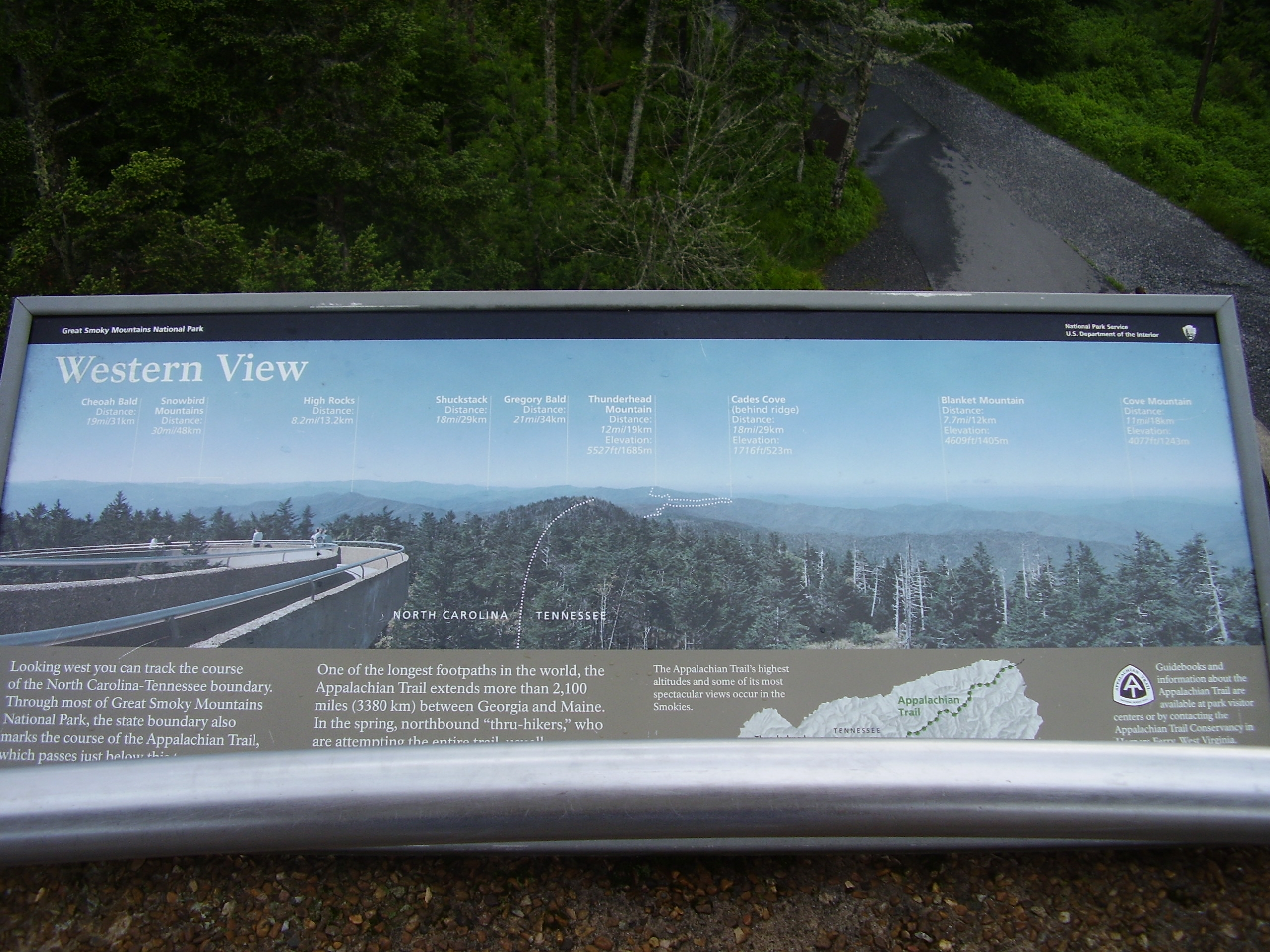
Western View | Additional Description: Looking west you can track the course of the North Carolina-Tennessee boundary. Through most of Great Smoky Mountains National Park, the state boundary also marks the course of the Appalachian Trail, which passes just below this tower. The trail leaves the boundary near Gregory Bald, cutting south toward Shuckstack.
One of the longest footpaths in the world, the Appalachian Trail extends more than 2,100 miles (3380 km) between Georgia and Maine. In the spring, northbound "thru-hikers," who are attempting the entire trail, usually pause here to enjoy the view. At 6,643 feet (2025m), Clingmans Dome is the trail's highest point.
Submitted: June 27, 2011, by Stanley and Terrie Howard of Greer, South Carolina.
Database Locator Identification Number: p159057
File Size: 1.095 Megabytes
To see the metadata that may be embedded in this photo, sign in and then return to this page.