Photograph as originally submitted to
this page in the Historical Marker Database
www.HMdb.org.
Click on photo to resize in browser. Scroll down to see metadata.
Photographer: NOAA Satellite and Information Service
Taken: April 1, 1960
Caption:
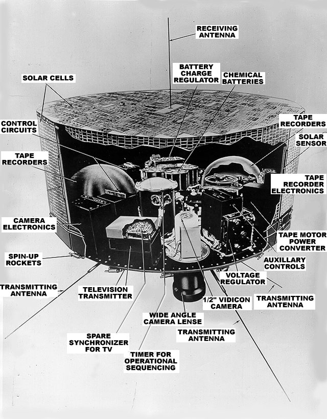
Instruments and equipment of the TIROS I | Additional Description: The main sensors that provided the cloud pictures were television cameras. The TIROS cameras were slow-scan devices that take snapshots of the scene below; one "snapshot" was taken every ten seconds. These were rugged, lightweight devices weighing only about 4.5 pounds (2 kg) including the camera lense. TIROS I was equipped with two cameras. One had a wide angle lense providing views that were approximately 750 miles (1207 km) on a side (with the satellite looking straight down), and a narrow angle camera with a view that was about 80 miles (129 km) on a side.
Submitted: July 14, 2011, by Mike Wintermantel of Pittsburgh, Pennsylvania.
Database Locator Identification Number: p162112
File Size: 0.196 Megabytes
To see the metadata that may be embedded in this photo, sign in and then return to this page.