Photograph as originally submitted to
this page in the Historical Marker Database
www.HMdb.org.
Click on photo to resize in browser. Scroll down to see metadata.
Photographer: Unknown
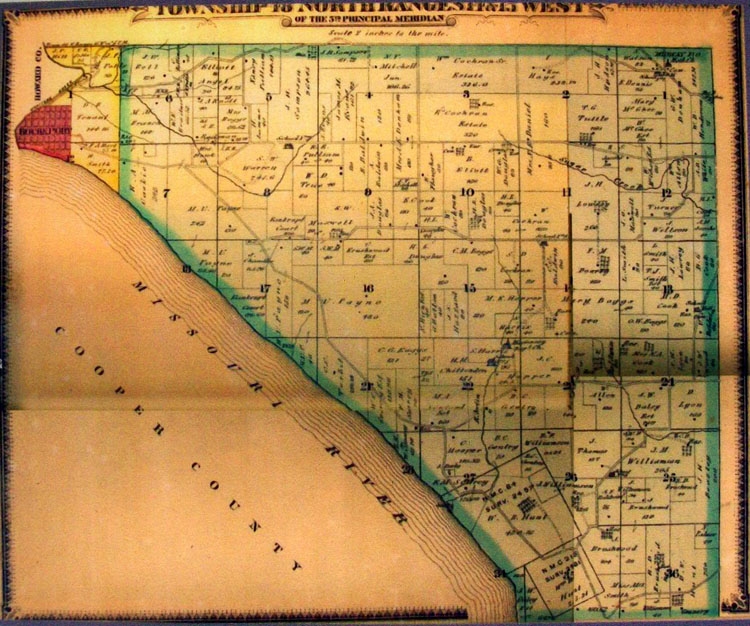
Taken: 1875
Caption:
1875 Map on History of Rocheport Marker | Additional Description: [Caption reads] In 1875, Rocheport was Boone County's main port on the Missouri River. Used by permission of the State Historical Society of Missouri.
Submitted: August 21, 2011, by William Fischer, Jr. of Scranton, Pennsylvania.
Database Locator Identification Number: p168683
File Size: 0.189 Megabytes
To see the metadata that may be embedded in this photo, sign in and then return to this page.