Photograph as originally submitted to
this page in the Historical Marker Database
www.HMdb.org.
Click on photo to resize in browser. Scroll down to see metadata.
Photographer: Missouri Dept of Natural Resources
Taken: Undated
Caption:
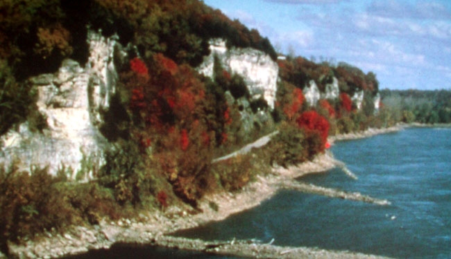
Background Photo on Jones Marker | Additional Description: [Caption reads] The Katy Trail passes along the Big Manitou bluffs and Missouri River south of Rocheport. The trail opened here in 1990, thanks to contributions from Ted and Pat Jones.
Submitted: August 22, 2011, by William Fischer, Jr. of Scranton, Pennsylvania.
Database Locator Identification Number: p168904
File Size: 0.079 Megabytes
To see the metadata that may be embedded in this photo, sign in and then return to this page.