Photograph as originally submitted to
this page in the Historical Marker Database
www.HMdb.org.
Click on photo to resize in browser. Scroll down to see metadata.
Photographer: Paul Fehrenbach
Taken: August 23, 2011
Caption:
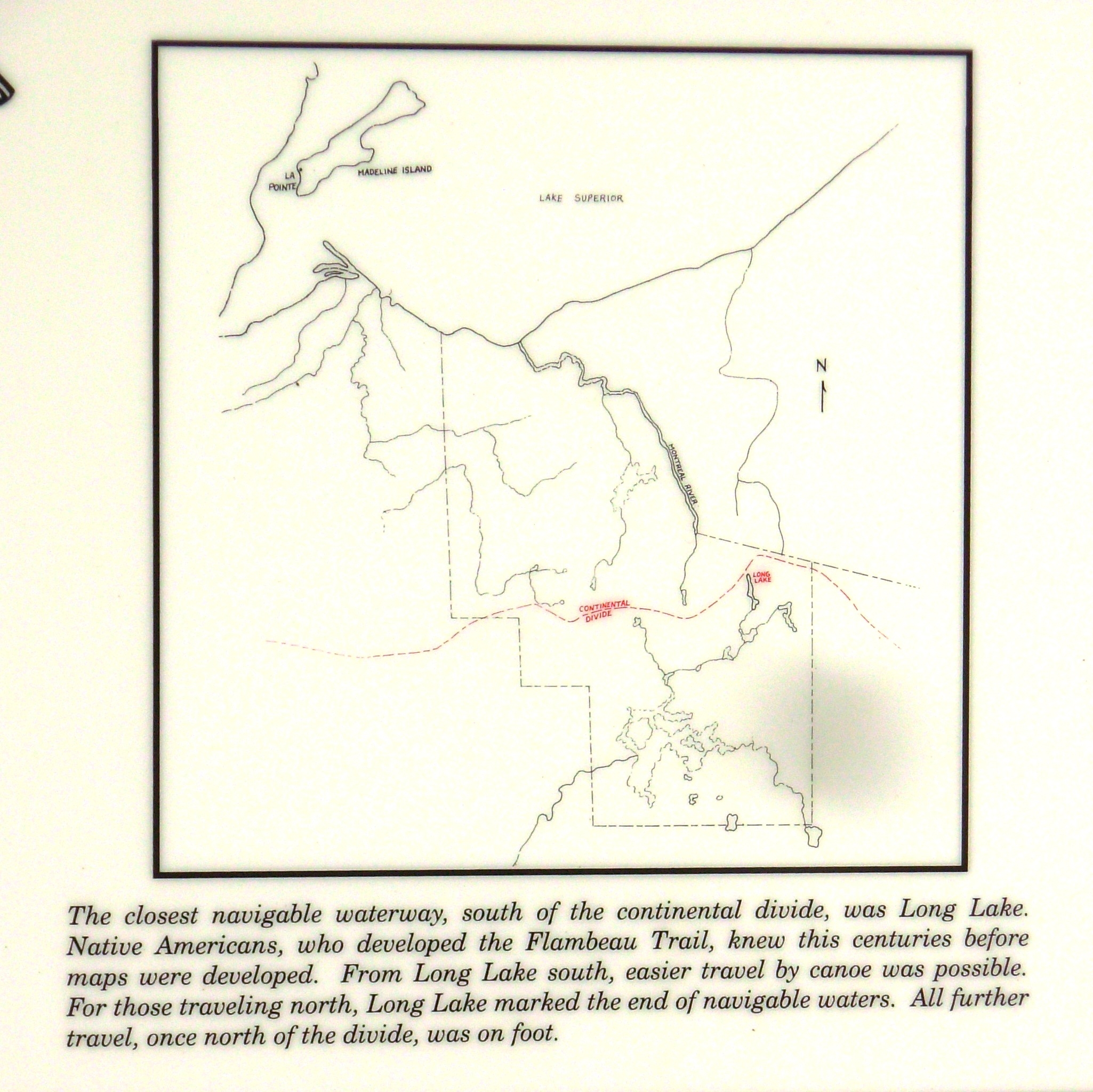
Flambeau Trail – Continental Divide Marker | Additional Description: Inset: The closest navigable waterway, south of the continental divide, was Long Lake. Native Americans, who developed the Flambeau Trail, knew this centuries before maps were developed. From Long Lake south, easier travel by canoe was possible. For those traveling north, Long Lake marked the end of the navigable waters. All further travel, once north of the divide, was on foot.
Submitted: August 30, 2011, by Paul Fehrenbach of Germantown, Wisconsin.
Database Locator Identification Number: p170062
File Size: 0.806 Megabytes
To see the metadata that may be embedded in this photo, sign in and then return to this page.