Photograph as originally submitted to
this page in the Historical Marker Database
www.HMdb.org.
Click on photo to resize in browser. Scroll down to see metadata.
Photographer: Unknown
Taken: undated
Caption:
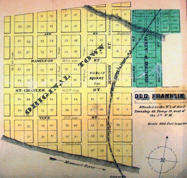
Plot Map on History of New Franklin Marker | Additional Description: [Caption reads] Franklin's location in the floodplain would lead to the town's destruction only 12 years after it was established. Used by permission, State Historical Society of Missouri, Columbia.
Submitted: September 9, 2011, by William Fischer, Jr. of Scranton, Pennsylvania.
Database Locator Identification Number: p171363
File Size: 0.171 Megabytes
To see the metadata that may be embedded in this photo, sign in and then return to this page.