Photograph as originally submitted to
this page in the Historical Marker Database
www.HMdb.org.
Click on photo to resize in browser. Scroll down to see metadata.
Photographer: Howard C. Ohlhous
Taken: November 29, 2008
Caption:
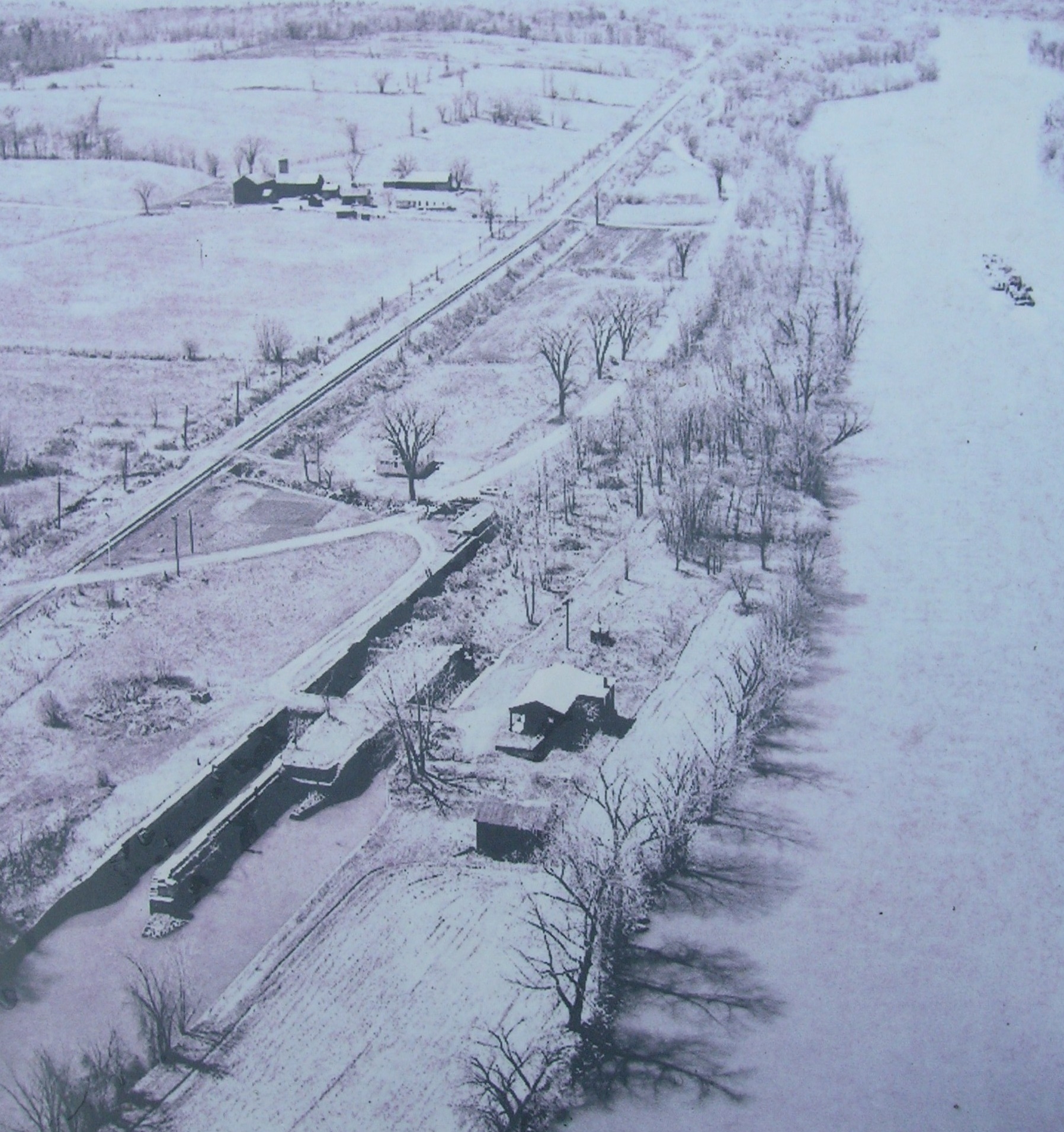
Putman's Lock Grocery | Additional Description: This is a view of the Mohawk River to the west. The abandoned canal and Grocery are in the lower portion of the photo, with canal lock #28 on the left and the Barge Canal / Mohawk River on the right. This photo is from another display nearby. The roadway that was built to the former grocery building by filling in part of the lock is shown. Also the rail bed to the south of the road appears to still have rail and a line of telegraph poles. The former railroad right of way is now the bike path, which is part of the state-wide Canalway Trail that follows the Erie Canal from Buffalo to Albany.
Submitted: September 24, 2011, by Howard C. Ohlhous of Duanesburg, New York.
Database Locator Identification Number: p173602
File Size: 0.764 Megabytes
To see the metadata that may be embedded in this photo, sign in and then return to this page.