Photograph as originally submitted to
this page in the Historical Marker Database
www.HMdb.org.
Click on photo to resize in browser. Scroll down to see metadata.
Photographer: National Park Service
Taken: undated
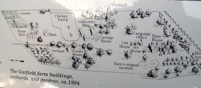
Caption:
Map on Garfield's Farm Marker | Additional Description: [Caption reads] The Garfield farm buildings, orchards, and gardens, ca. 1894
Submitted: November 3, 2011, by William Fischer, Jr. of Scranton, Pennsylvania.
Database Locator Identification Number: p179341
File Size: 0.076 Megabytes
To see the metadata that may be embedded in this photo, sign in and then return to this page.