Photograph as originally submitted to
this page in the Historical Marker Database
www.HMdb.org.
Click on photo to resize in browser. Scroll down to see metadata.
Photographer: Barry Swackhamer
Taken: October 23, 2011
Caption:
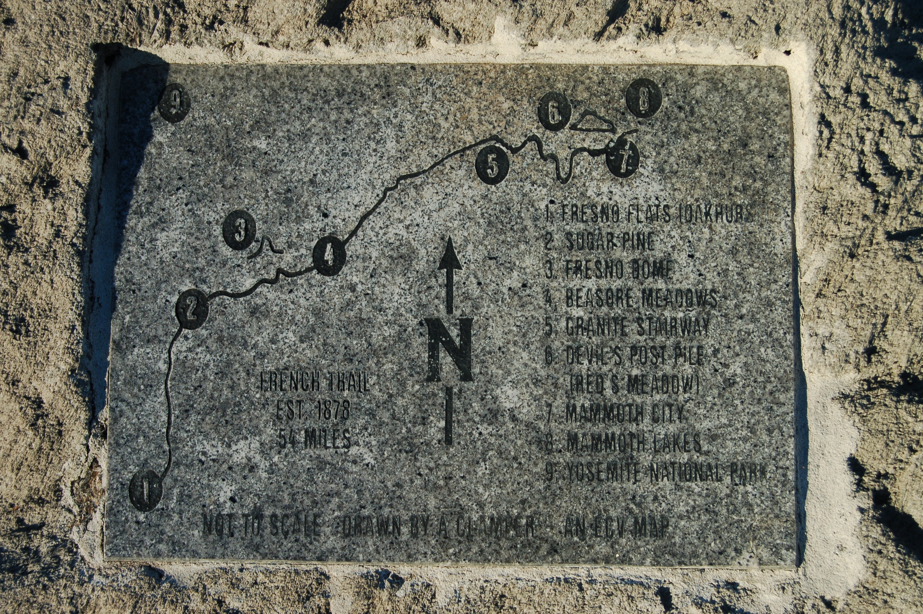
Old French Trail Map Marker | Additional Description: This marker is located on the back of the Old French Trail Marker boulder.
French Trail
Est. 1878
54 Miles
1. Fresno Flat (Oakhurst), 2. Sugar Pine, 3. Fresno Dome, 4. Beasore Meadows, 5. Granite Stairway, 6. Devil’s Post Pile, 7. Mammoth City, 8. Mammoth Lakes
9. Yosemite National Park
Not to Scale - Drawn by a Clamper - An ECV Map
Submitted: November 30, 2011, by Barry Swackhamer of Brentwood, California.
Database Locator Identification Number: p182984
File Size: 3.023 Megabytes
To see the metadata that may be embedded in this photo, sign in and then return to this page.