Photograph as originally submitted to
this page in the Historical Marker Database
www.HMdb.org.
Click on photo to resize in browser. Scroll down to see metadata.
Photographer: Michael Kindig
Taken: June 22, 2008
Caption:
Fullerton Municipal Airport Marker | Additional Description:
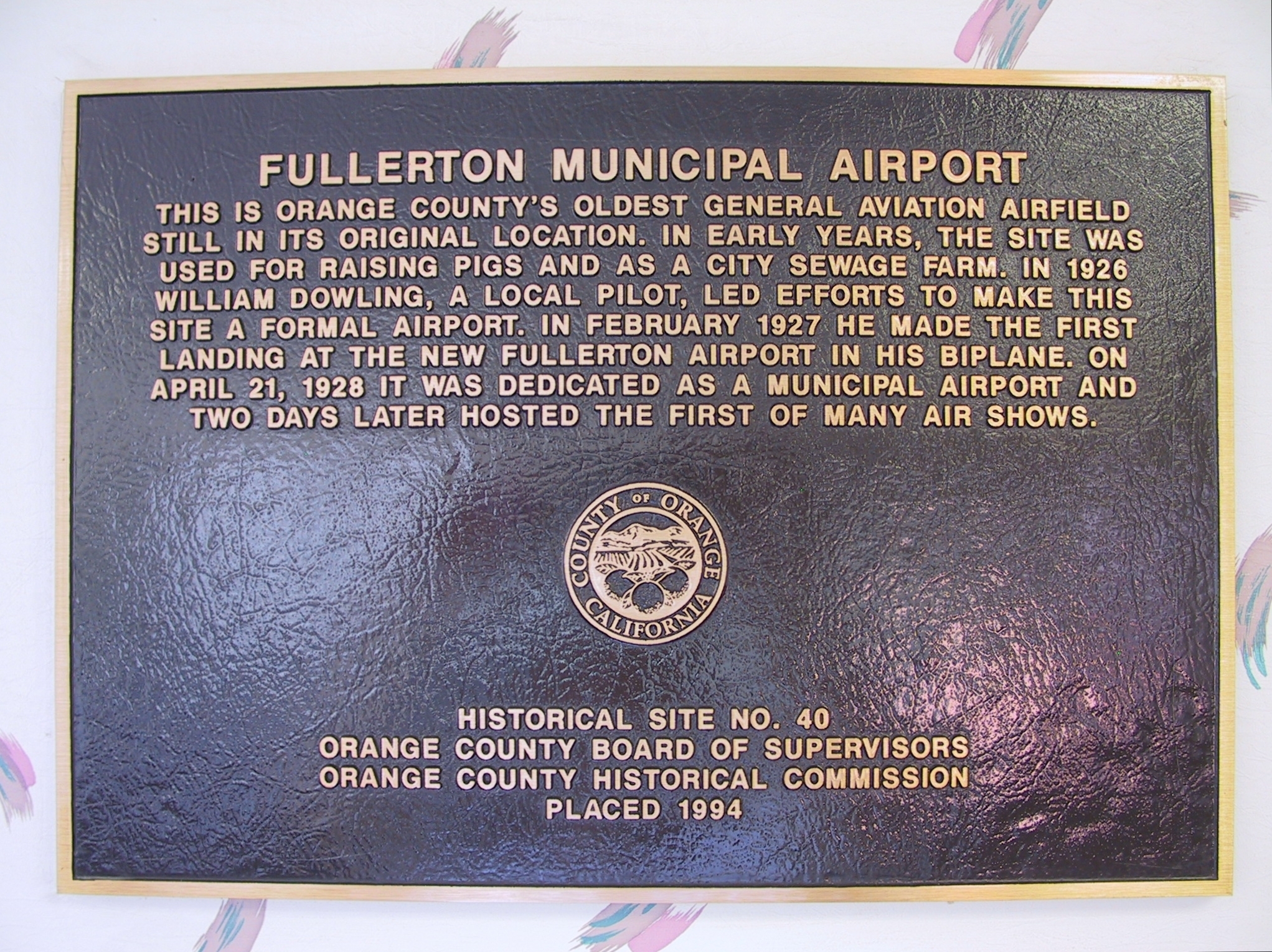
One mile east of the Lily Creamery Marker is the Fullerton Airport. This marker is mounted on the wall inside the terminal.
This is Orange County's oldest general aviation airfield still in its orginal location. In early years, the site was used for raising pigs and as a city sewage farm. In 1926 William Dowling, a local pilot, led efforts to make this site a formal airport. In February 1927 he made the first landing at the new Fullerton Airport in his biplane. On April 21, 1928 it was dedicated as a municpal airport and two days later hosted the first of many air shows.
Marker is located at 4011 Commonwealth Avenue, Fullerton, CA.
Submitted: November 30, 2011, by Michael Kindig of Elk Grove, California.
Database Locator Identification Number: p183465
File Size: 1.658 Megabytes
To see the metadata that may be embedded in this photo, sign in and then return to this page.