Photograph as originally submitted to
this page in the Historical Marker Database
www.HMdb.org.
Click on photo to resize in browser. Scroll down to see metadata.
Photographer: Kcahta
Taken: 2006
Caption:
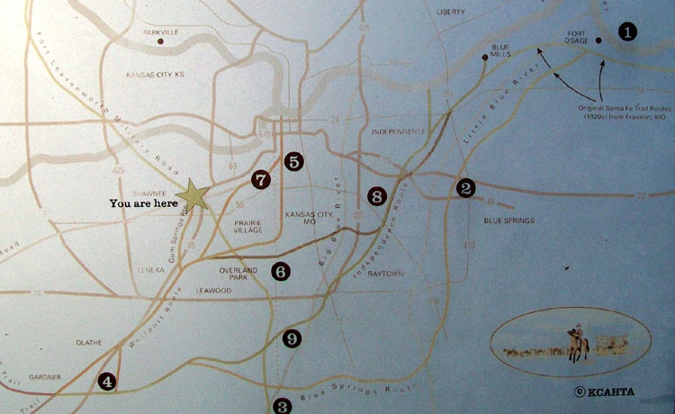
Map on The Development of the Kansas City area Frontier Trails Network Marker | Submitted: December 18, 2011, by William Fischer, Jr. of Scranton, Pennsylvania.
Database Locator Identification Number: p185332
File Size: 0.100 Megabytes
To see the metadata that may be embedded in this photo, sign in and then return to this page.