Photograph as originally submitted to
this page in the Historical Marker Database
www.HMdb.org.
Click on photo to resize in browser. Scroll down to see metadata.
Photographer: Bill Coughlin
Taken: April 24, 2007
Caption:
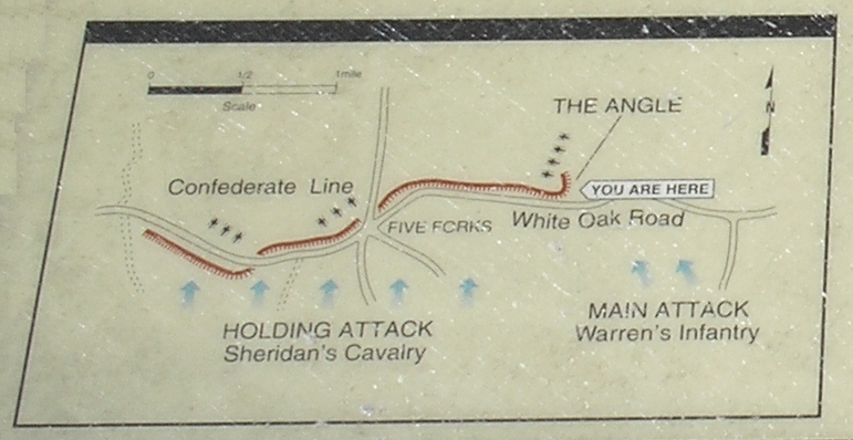
Map Detail | Additional Description: This map shows the Confederate fortifications around Five Forks and the Union lines of attack. The marker is located at the Angle at Warren's main attack area, to the left of the map.
Submitted: March 15, 2008, by Bill Coughlin of Woodland Park, New Jersey.
Database Locator Identification Number: p18579
File Size: 0.922 Megabytes
To see the metadata that may be embedded in this photo, sign in and then return to this page.