Photograph as originally submitted to
this page in the Historical Marker Database
www.HMdb.org.
Click on photo to resize in browser. Scroll down to see metadata.
Photographer: Lora Mueller
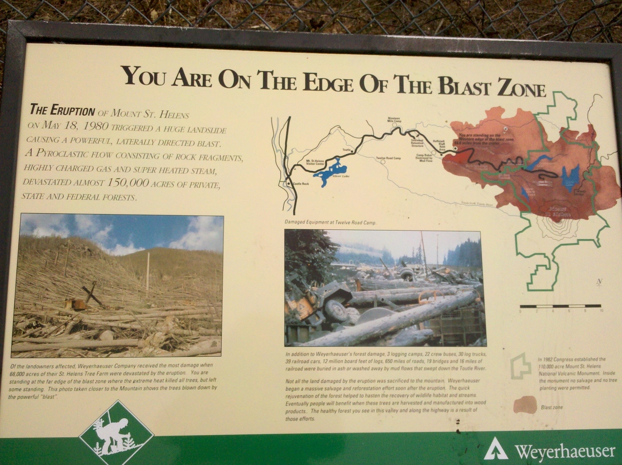
Caption:
Close-Up of Photo Displayed on Marker | Additional Description: Of the landowners affected, Weyerhaeuser Company received the most damage when 68,000 acres of their St. Helens Tree Farm were devastated by the eruption. You are standing at the far edge of the blast zone where the extreme heat killed all the trees, but left some standing. This photo taken closer to the Mountain shows the trees blown down by the powerful "blast".
Submitted: December 19, 2011, by Lora Wilson of Paw Paw, West Virginia.
Database Locator Identification Number: p186884
File Size: 0.551 Megabytes
To see the metadata that may be embedded in this photo, sign in and then return to this page.