Photograph as originally submitted to
this page in the Historical Marker Database
www.HMdb.org.
Click on photo to resize in browser. Scroll down to see metadata.
Photographer: Courtesy National Archives and Records Administration, Pacific Branch, Laguna Niguel, California.
Taken: June 30, 2000
Caption:
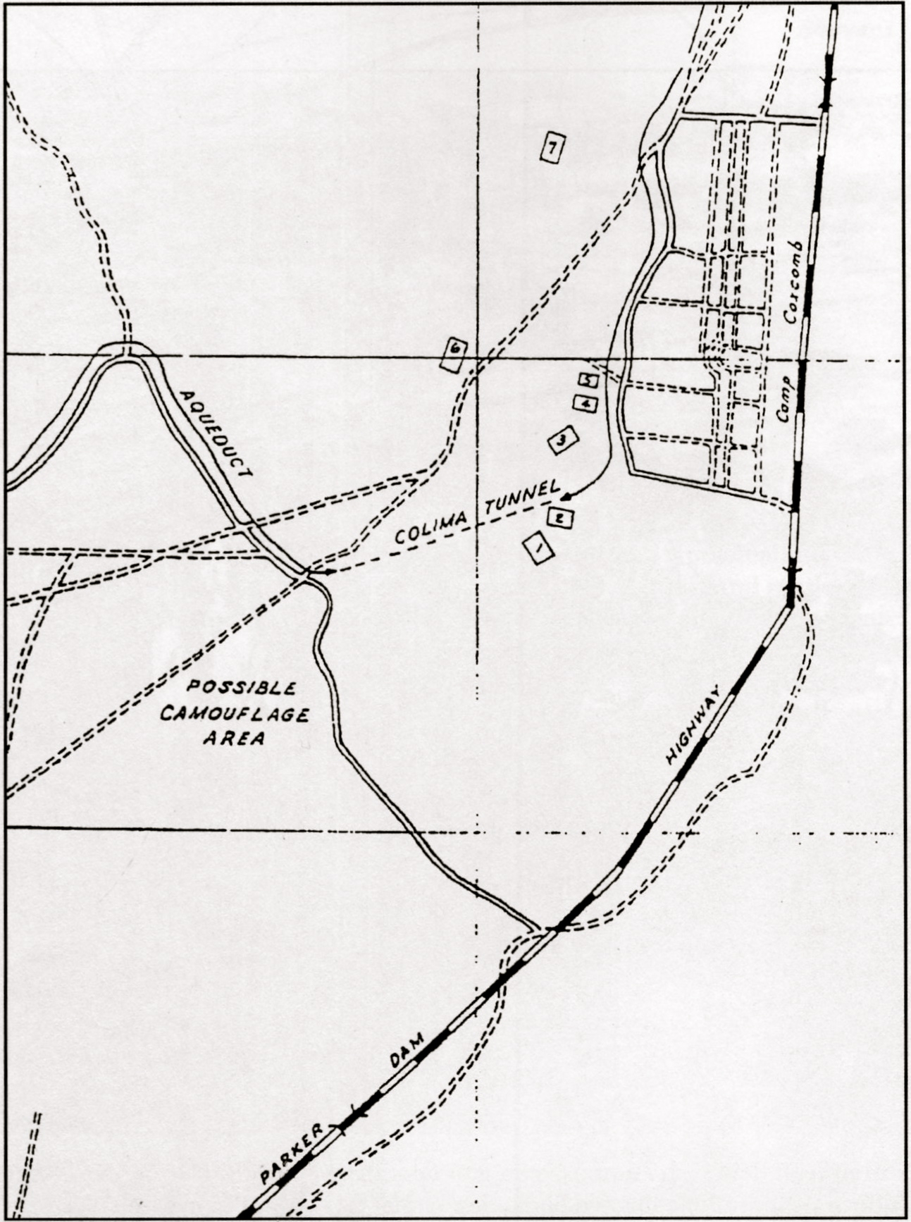
Map of Camp Coxcomb and Vicinity (ca. 1943) | Submitted: December 30, 2011, by Michael Kindig of Elk Grove, California.
Database Locator Identification Number: p187130
File Size: 0.622 Megabytes
To see the metadata that may be embedded in this photo, sign in and then return to this page.