Photograph as originally submitted to
this page in the Historical Marker Database
www.HMdb.org.
Click on photo to resize in browser. Scroll down to see metadata.
Photographer: National Park Service
Taken: undated
Caption:
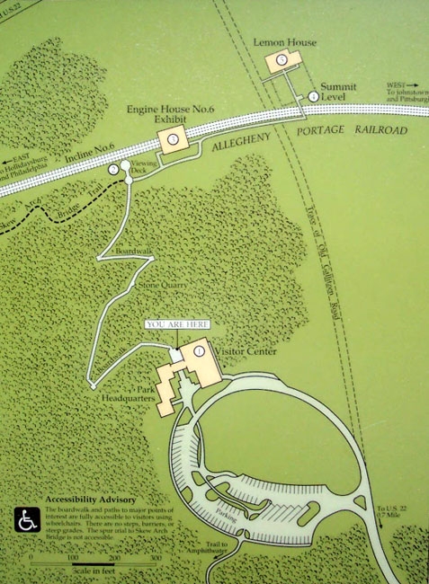
Summit Level Historic Area Map on Marker | Submitted: March 22, 2012, by William Fischer, Jr. of Scranton, Pennsylvania.
Database Locator Identification Number: p197432
File Size: 0.130 Megabytes
To see the metadata that may be embedded in this photo, sign in and then return to this page.