Photograph as originally submitted to
this page in the Historical Marker Database
www.HMdb.org.
Click on photo to resize in browser. Scroll down to see metadata.
Photographer: Anna Inbody
Taken: March 18, 2012
Caption:
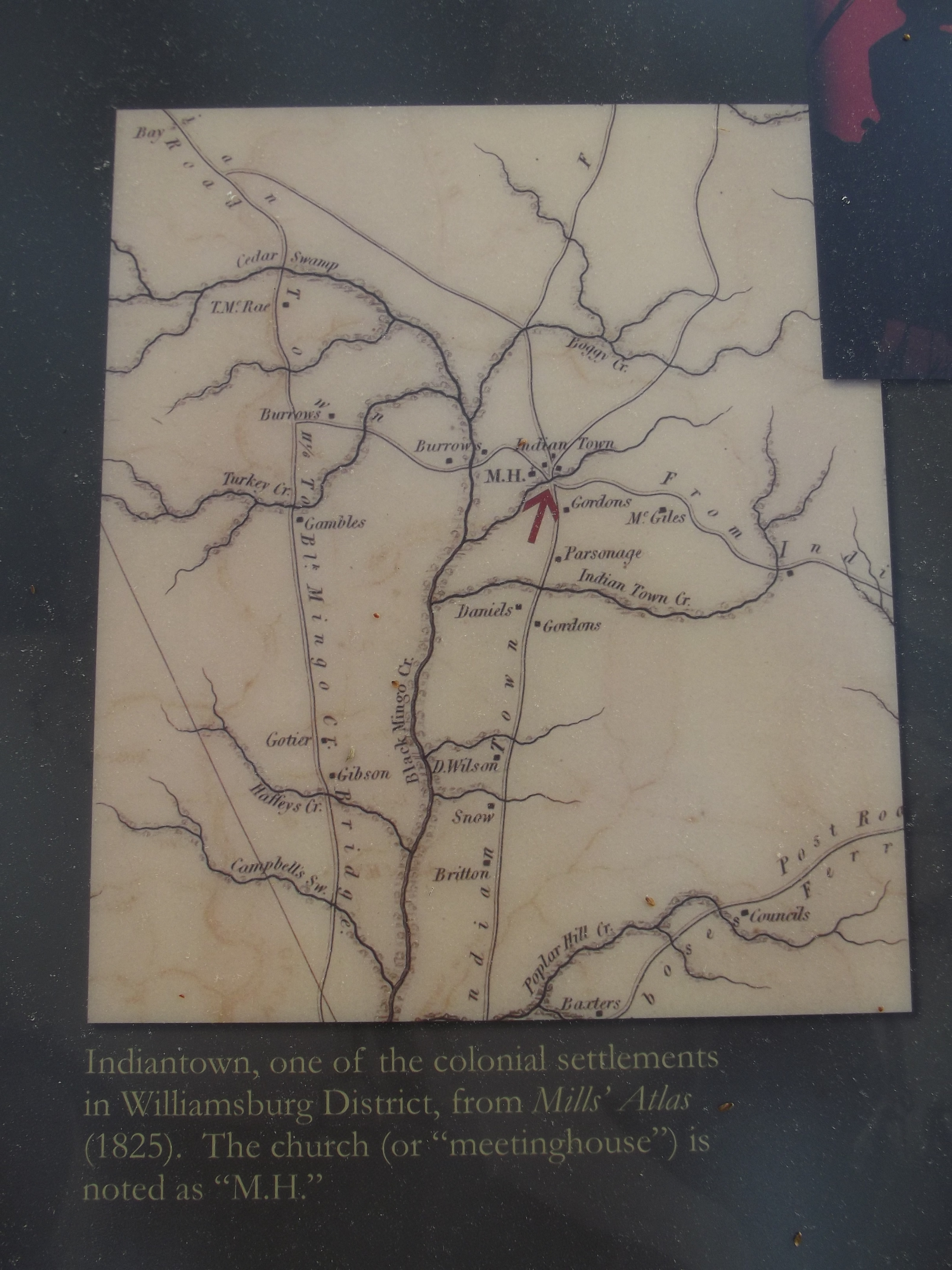
Map on the marker | Additional Description: Indiantown, one of the colonial settlements in Williamsburg District, from
Mills‘ Atlas (1825). The church (or "meetinghouse") is noted as “M.H.”
Submitted: March 25, 2012, by Anna Inbody of Columbia, South Carolina.
Database Locator Identification Number: p197833
File Size: 3.800 Megabytes
To see the metadata that may be embedded in this photo, sign in and then return to this page.