Photograph as originally submitted to
this page in the Historical Marker Database
www.HMdb.org.
Click on photo to resize in browser. Scroll down to see metadata.
Photographer: Google Maps
Taken: March 20, 2008
Caption:
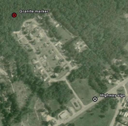
Aerial view of roadside historical marker and nearby granite death spot memorial locations | Additional Description: The granite marker commemorating the actual spot of Hill's death is located about 1/3 mile away from the highway sign, in a forested area just off the road in the nearby housing development. Use these coordinates ( N 37° 11.553 W 077° 28.847 ) and look for the Civil War Preservation Trust signs affixed to the trees as a clue you are getting close.
Submitted: March 27, 2008, by Harold Colson of San Diego, California.
Database Locator Identification Number: p19970
File Size: 0.054 Megabytes
To see the metadata that may be embedded in this photo, sign in and then return to this page.