Photograph as originally submitted to
this page in the Historical Marker Database
www.HMdb.org.
Click on photo to resize in browser. Scroll down to see metadata.
Caption:
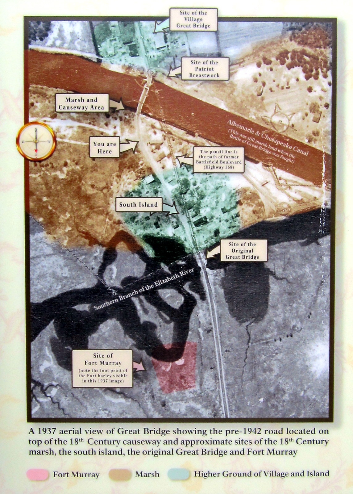
Orientation Overview | Additional Description: A 1937 aerial view of Great Bridge showing the pre-1942 road located on top of the 18th Century causeway and approximate site of the 18th Century marsh, the south island, the original Great Bridge and Fort Murray. Fort Murray/Marsh/Higher ground of village and island
Submitted: April 29, 2012, by Bernard Fisher of Richmond, Virginia.
Database Locator Identification Number: p202215
File Size: 0.505 Megabytes
To see the metadata that may be embedded in this photo, sign in and then return to this page.