Photograph as originally submitted to
this page in the Historical Marker Database
www.HMdb.org.
Click on photo to resize in browser. Scroll down to see metadata.
Caption:
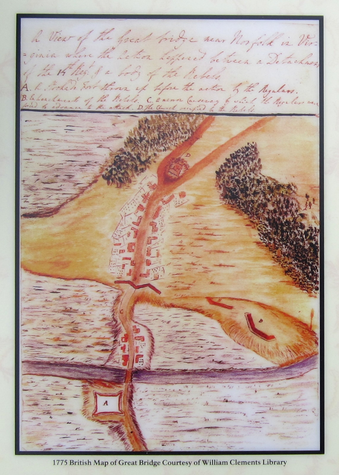
1775 British Map of Great Bridge Courtesy of William Clements Library | Additional Description: South is at the top of the map. The Village of Great Bridge is below the letter “D” which identifies the Patriot encampment. The Patriot breastworks are marked by the letter “B.” The causeway is marked as “C.” The upper portion of the causeway is today’s location of the A & C Canal and the modern bridge. Below the causeway is the South Island and the Great Bridge crossing the Southern Branch of the Elizabeth River. Fort Murray is at the bottom of the map north of the bridge marked as “A.”
Submitted: April 29, 2012, by Bernard Fisher of Richmond, Virginia.
Database Locator Identification Number: p202228
File Size: 0.405 Megabytes
To see the metadata that may be embedded in this photo, sign in and then return to this page.