Photograph as originally submitted to
this page in the Historical Marker Database
www.HMdb.org.
Click on photo to resize in browser. Scroll down to see metadata.
Photographer: Bill Coughlin
Taken: June 8, 2012
Caption:
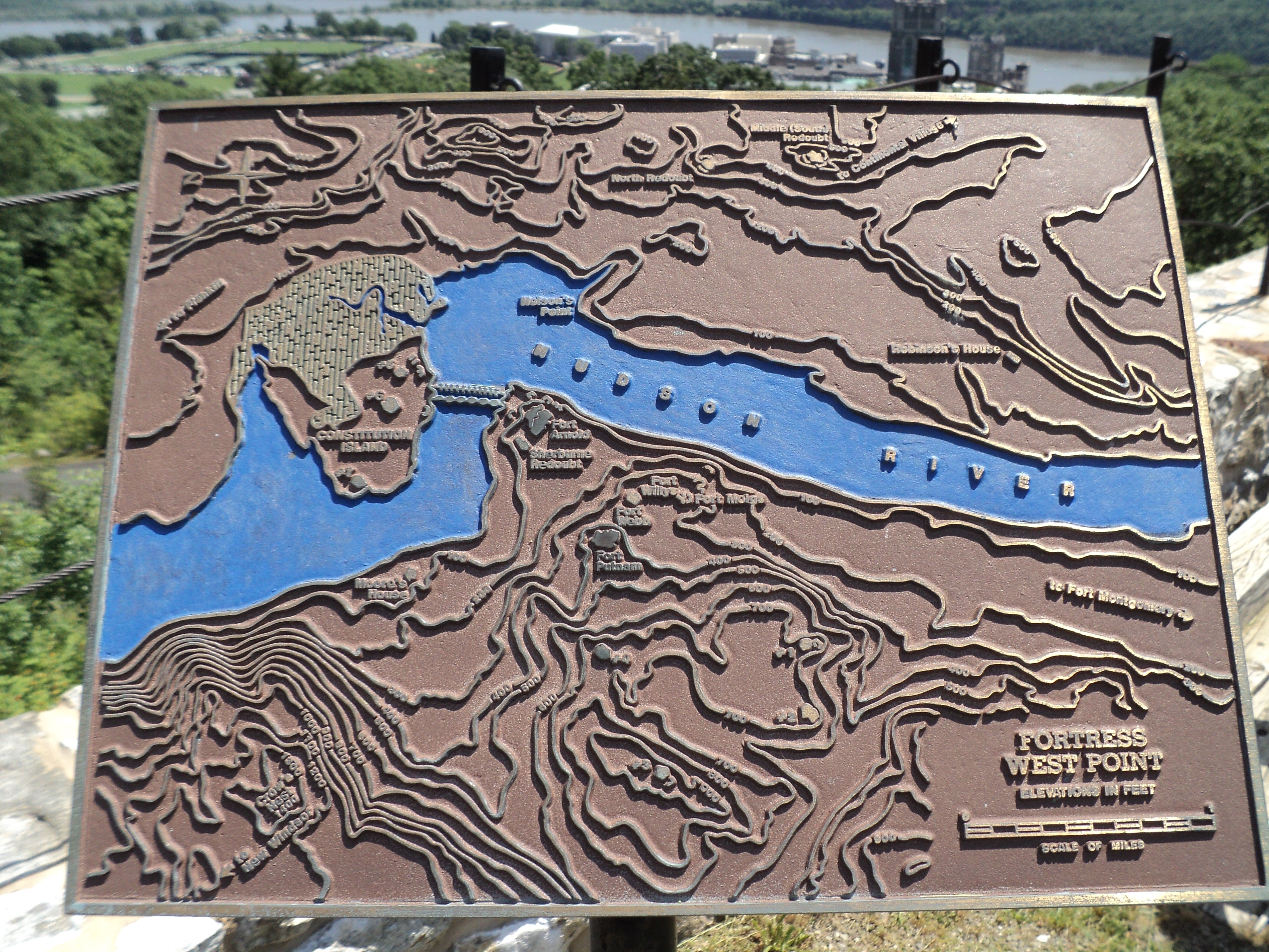
Fortress West Point | Additional Description:
Placed near the marker:
Elevations in Feet
Marker features a map of West Point and Constitution Island, showing the Great Chain across the Hudson River and the locations of Fort Arnold, Sherburne Redoubt, Fort Willys, Fort Meigs, Fort Webb, Fort Putam, Crow’s Nest and Moore’s House on the west side the Hudson River, and the North Redoubt, Middle (South) Redoubt, Nelson’s Point and Robinson’s House on the east side.
Submitted: June 9, 2012, by Bill Coughlin of Woodland Park, New Jersey.
Database Locator Identification Number: p207393
File Size: 4.506 Megabytes
To see the metadata that may be embedded in this photo, sign in and then return to this page.