Photograph as originally submitted to
this page in the Historical Marker Database
www.HMdb.org.
Click on photo to resize in browser. Scroll down to see metadata.
Photographer: Bill Coughlin
Taken: April 23, 2007
Caption:
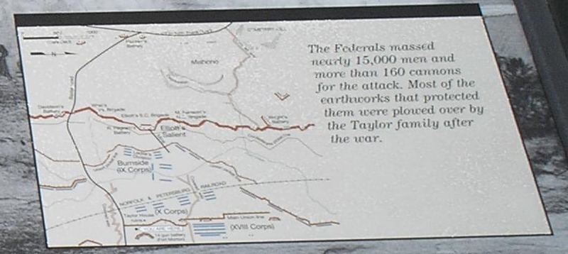
Detail of Marker Map | Additional Description: Map shows the Confederate and Union fortifications in the vicinity of the marker.
Submitted: April 12, 2008, by Bill Coughlin of Woodland Park, New Jersey.
Database Locator Identification Number: p21220
File Size: 0.859 Megabytes
To see the metadata that may be embedded in this photo, sign in and then return to this page.