Photograph as originally submitted to
this page in the Historical Marker Database
www.HMdb.org.
Click on photo to resize in browser. Scroll down to see metadata.
Photographer: Allen C. Browne
Taken: February 18, 2007
Caption:
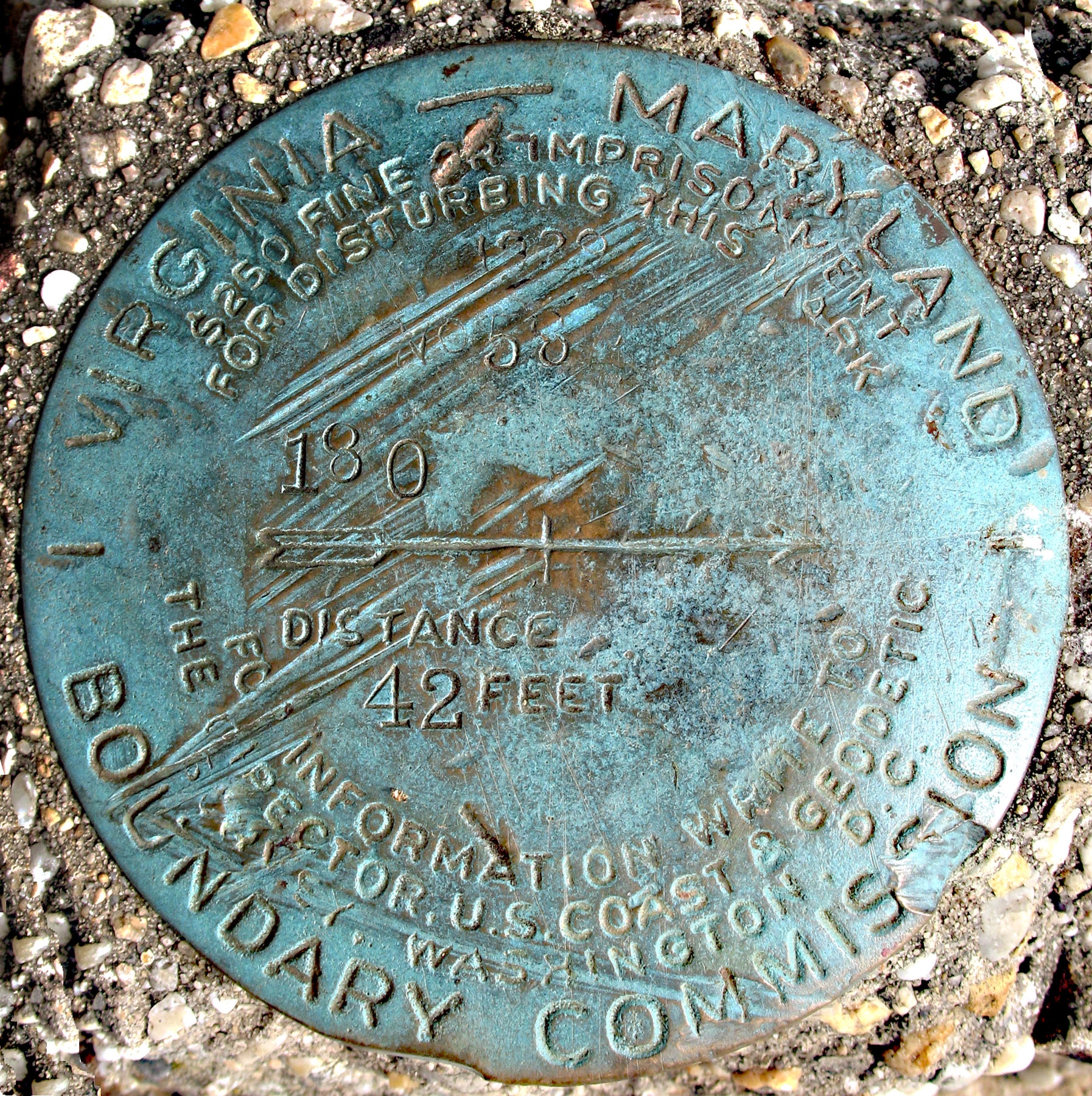
1929 Virginia-Maryland Boundary Commission marker | Additional Description: This disc points to the current south point of D.C. 42 feet south of this marker in the Potomac.
Submitted: October 10, 2012, by Allen C. Browne of Silver Spring, Maryland.
Database Locator Identification Number: p223000
File Size: 1.195 Megabytes
To see the metadata that may be embedded in this photo, sign in and then return to this page.