Photograph as originally submitted to
this page in the Historical Marker Database
www.HMdb.org.
Click on photo to resize in browser. Scroll down to see metadata.
Photographer: Bill Coughlin
Taken: April 23, 2008
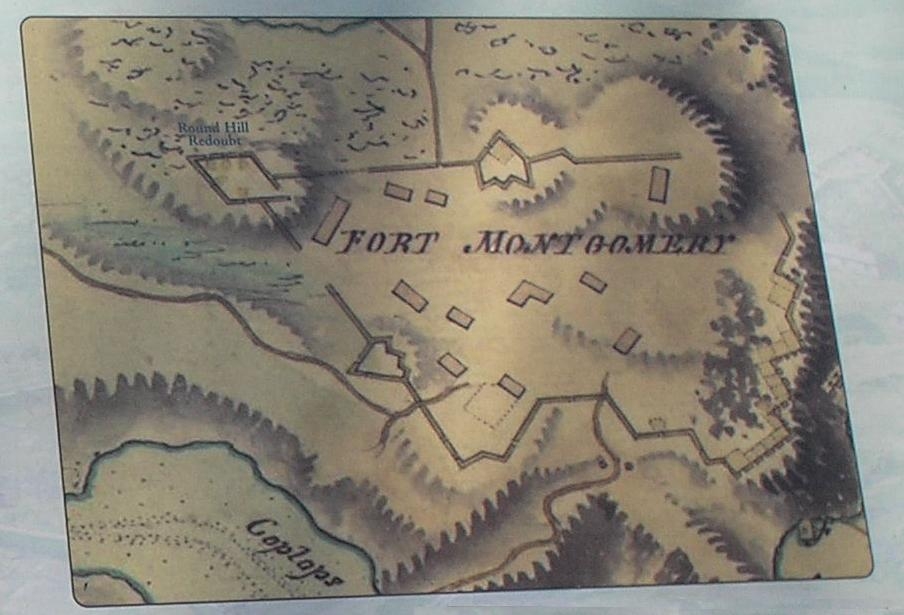
Caption:
Detail of Map from Marker | Additional Description: The Round Hill Redoubt is marked on this 18th century British map.
Submitted: May 4, 2008, by Bill Coughlin of Woodland Park, New Jersey.
Database Locator Identification Number: p23050
File Size: 0.072 Megabytes
To see the metadata that may be embedded in this photo, sign in and then return to this page.