Photograph as originally submitted to
this page in the Historical Marker Database
www.HMdb.org.
Click on photo to resize in browser. Scroll down to see metadata.
Photographer: Unknown
Taken: 1861
Caption:
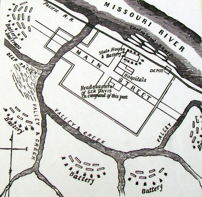
Image on The State Capital During The Civil War Marker | Additional Description:
[Caption reads] This 1861 map shows the defensive lines surrounding the Capitol. Used with permission, State Historical Society of Missouri, Columbia.Submitted: January 6, 2013, by William Fischer, Jr. of Scranton, Pennsylvania.
Database Locator Identification Number: p230719
File Size: 0.179 Megabytes
To see the metadata that may be embedded in this photo, sign in and then return to this page.