Photograph as originally submitted to
this page in the Historical Marker Database
www.HMdb.org.
Click on photo to resize in browser. Scroll down to see metadata.
Photographer: The Walled City of Charles Town Marker
Taken: 2012
Caption:
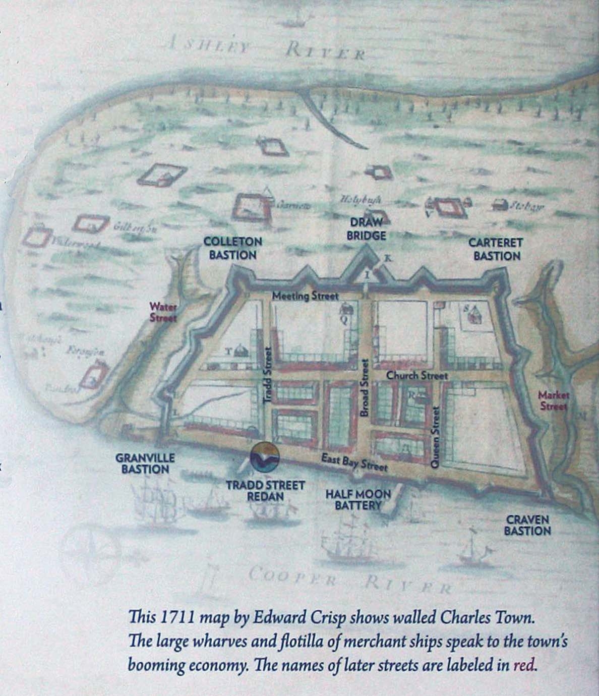
Map of the Walled City | Additional Description: This 1711 map by Edward Crisp shows walled Charles Town
Submitted: January 13, 2013, by Mike Stroud of Bluffton, South Carolina.
Database Locator Identification Number: p231235
File Size: 0.171 Megabytes
To see the metadata that may be embedded in this photo, sign in and then return to this page.