Photograph as originally submitted to
this page in the Historical Marker Database
www.HMdb.org.
Click on photo to resize in browser. Scroll down to see metadata.
Photographer: Allen C. Browne
Taken: April 14, 2013
Caption:
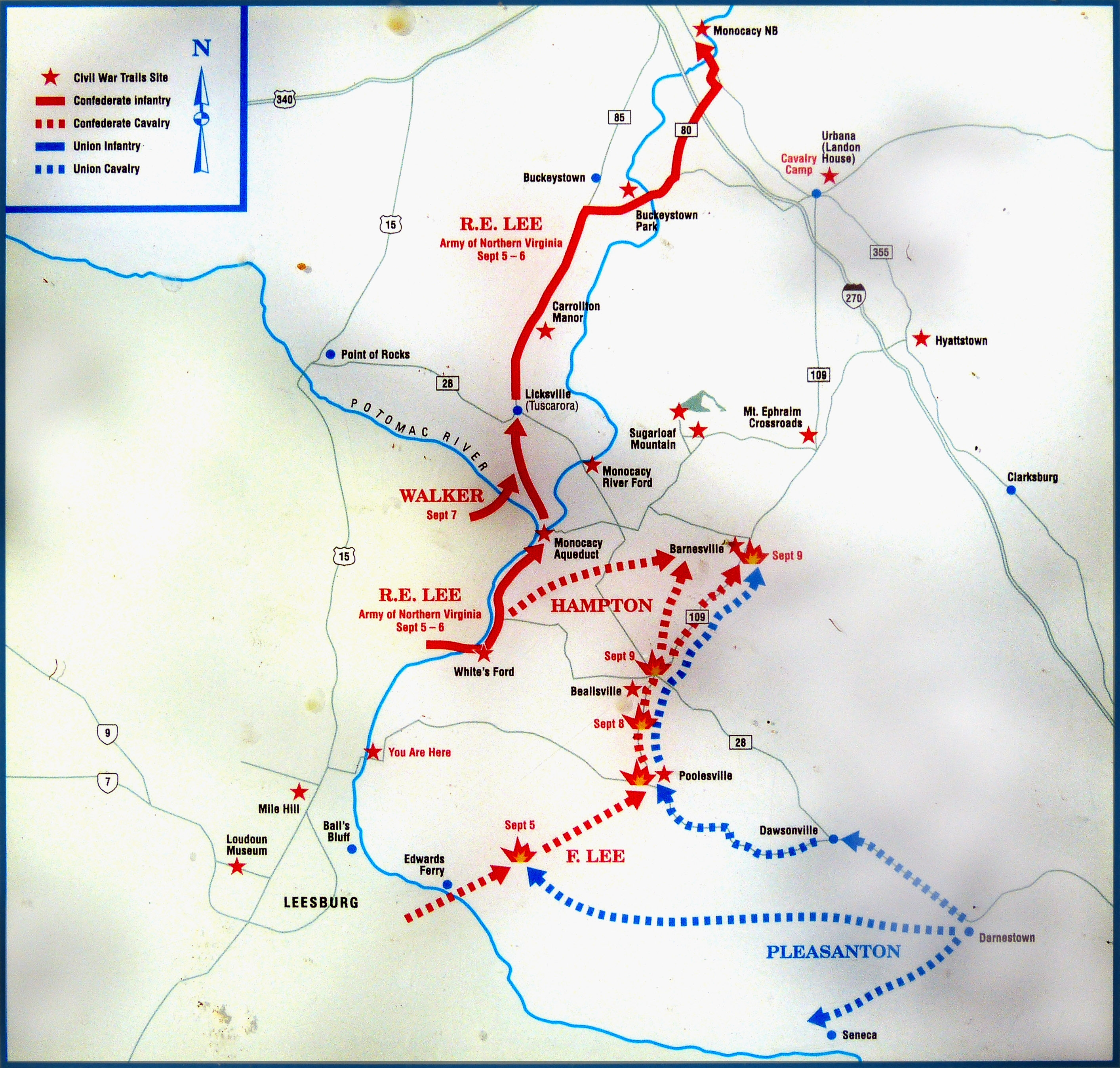
Map of the Antietam Campaign, 1862 | Submitted: May 6, 2013, by Allen C. Browne of Silver Spring, Maryland.
Database Locator Identification Number: p241370
File Size: 1.664 Megabytes
To see the metadata that may be embedded in this photo, sign in and then return to this page.